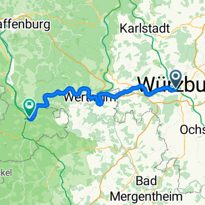
2016 - 2. Tag
A cycling route starting in Höchberg, Bavaria, Germany.
Overview
About this route
Höchberg - Großwallstadt
- -:--
- Duration
- 98.3 km
- Distance
- 217 m
- Ascent
- 360 m
- Descent
- ---
- Avg. speed
- ---
- Avg. speed
Route quality
Waytypes & surfaces along the route
Waytypes
Track
34.1 km
(35 %)
Quiet road
20.5 km
(21 %)
Surfaces
Paved
85.8 km
(87 %)
Unpaved
9.2 km
(9 %)
Asphalt
82.9 km
(84 %)
Gravel
5.2 km
(5 %)
Continue with Bikemap
Use, edit, or download this cycling route
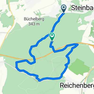
You would like to ride 2016 - 2. Tag or customize it for your own trip? Here is what you can do with this Bikemap route:
Free features
- Save this route as favorite or in collections
- Copy & plan your own version of this route
- Sync your route with Garmin or Wahoo
Premium features
Free trial for 3 days, or one-time payment. More about Bikemap Premium.
- Navigate this route on iOS & Android
- Export a GPX / KML file of this route
- Create your custom printout (try it for free)
- Download this route for offline navigation
Discover more Premium features.
Get Bikemap PremiumFrom our community
Other popular routes starting in Höchberg
- 1-Romantische Strasse-Hohenpeißenberg
- Distance
- 364.6 km
- Ascent
- 1,013 m
- Descent
- 556 m
- Location
- Höchberg, Bavaria, Germany
- Rund um den Blutsee
- Distance
- 30.3 km
- Ascent
- 380 m
- Descent
- 356 m
- Location
- Höchberg, Bavaria, Germany
- Nürnberg - Koblenz Etappe 6/13
- Distance
- 43.5 km
- Ascent
- 56 m
- Descent
- 64 m
- Location
- Höchberg, Bavaria, Germany
- Würzburg-Aschaffenburg, Mainradweg
- Distance
- 131.2 km
- Ascent
- 328 m
- Descent
- 406 m
- Location
- Höchberg, Bavaria, Germany
- 2-Romantische-Straße-Hohenpeißenberg
- Distance
- 333.5 km
- Ascent
- 1,081 m
- Descent
- 614 m
- Location
- Höchberg, Bavaria, Germany
- Schwanberg
- Distance
- 81.3 km
- Ascent
- 597 m
- Descent
- 592 m
- Location
- Höchberg, Bavaria, Germany
- Karlshöhe
- Distance
- 81.7 km
- Ascent
- 682 m
- Descent
- 686 m
- Location
- Höchberg, Bavaria, Germany
- Lange Runde
- Distance
- 111.9 km
- Ascent
- 538 m
- Descent
- 520 m
- Location
- Höchberg, Bavaria, Germany
Open it in the app