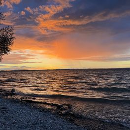
Vier - Schluchten Tour
A cycling route starting in Starnberg, Bavaria, Germany.
Overview
About this route
Between Lake Starnberger and Lake Ammersee. Starnberg (1. Maisinger Gorge) -> Andechs -> Pähl (2. Pähler Gorge, on foot only) -> Tutzing (3. Waldschmidt Gorge) -> Feldafing (4. Wolf Gorge) -> Starnberg.
(cloned from route 415093)- -:--
- Duration
- 55.7 km
- Distance
- 365 m
- Ascent
- 364 m
- Descent
- ---
- Avg. speed
- ---
- Max. altitude
Route highlights
Points of interest along the route
Point of interest after 8.6 km
1. Schlucht: Maisinger Schlucht
Point of interest after 11 km
Biergarten am Maisinger See
Point of interest after 21.5 km
Andechser Kloster mit Biergarten
Point of interest after 22.6 km
Starke Steigung: Länge ca. 200m
Point of interest after 24.5 km
Höhenweg
Point of interest after 28.6 km
2. Pählerschlucht mit Wasserfall
Point of interest after 29.7 km
Restaurant mit Biergarten: Aussicht bis zur Zugspitze
Point of interest after 36 km
Biergarten mit Aussicht
Point of interest after 40.1 km
3. Waldschmidtschlucht
Point of interest after 42.5 km
Moorwiese (Fahrrad schieben)
Point of interest after 46.5 km
4. Wolfsschlucht
Point of interest after 47.4 km
Sissi Schloss
Continue with Bikemap
Use, edit, or download this cycling route
You would like to ride Vier - Schluchten Tour or customize it for your own trip? Here is what you can do with this Bikemap route:
Free features
- Save this route as favorite or in collections
- Copy & plan your own version of this route
- Sync your route with Garmin or Wahoo
Premium features
Free trial for 3 days, or one-time payment. More about Bikemap Premium.
- Navigate this route on iOS & Android
- Export a GPX / KML file of this route
- Create your custom printout (try it for free)
- Download this route for offline navigation
Discover more Premium features.
Get Bikemap PremiumFrom our community
Other popular routes starting in Starnberg
 STA-Leutstetten-Wangen-STA
- Distance
- 15 km
- Ascent
- 172 m
- Descent
- 169 m
- Location
- Starnberg, Bavaria, Germany
 Starnberger See umrunden
- Distance
- 53 km
- Ascent
- 365 m
- Descent
- 311 m
- Location
- Starnberg, Bavaria, Germany
 Runde um den Starnberger See
- Distance
- 56.6 km
- Ascent
- 105 m
- Descent
- 105 m
- Location
- Starnberg, Bavaria, Germany
 Vier - Schluchten Tour
- Distance
- 55.7 km
- Ascent
- 365 m
- Descent
- 364 m
- Location
- Starnberg, Bavaria, Germany
 STARNBERGER SEE
- Distance
- 52.6 km
- Ascent
- 74 m
- Descent
- 74 m
- Location
- Starnberg, Bavaria, Germany
 Handbike Starnberg über Villa Rustica Bachausen Berg und zurück
- Distance
- 34 km
- Ascent
- 361 m
- Descent
- 362 m
- Location
- Starnberg, Bavaria, Germany
 Starnberg-Dachau 2023-07-13 19:44:21
- Distance
- 51.2 km
- Ascent
- 178 m
- Descent
- 285 m
- Location
- Starnberg, Bavaria, Germany
 Starnberger See Teil 2
- Distance
- 26 km
- Ascent
- 205 m
- Descent
- 191 m
- Location
- Starnberg, Bavaria, Germany
Open it in the app


