

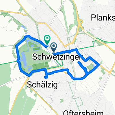
RTF Odenwaldtour
A cycling route starting in Schwetzingen, Baden-Wurttemberg, Germany.
Overview
About this route
RTF Odenwaldtour by RC Chio Mannheim 1955 e.V. (cloned from route 2857751)
- -:--
- Duration
- 80.7 km
- Distance
- 905 m
- Ascent
- 904 m
- Descent
- ---
- Avg. speed
- ---
- Max. altitude

Route quality
Waytypes & surfaces along the route
Waytypes
Road
20.2 km
(25 %)
Track
12.9 km
(16 %)
Surfaces
Paved
75.9 km
(94 %)
Unpaved
0.8 km
(1 %)
Asphalt
72.6 km
(90 %)
Paved (undefined)
3.2 km
(4 %)
Continue with Bikemap
Use, edit, or download this cycling route
You would like to ride RTF Odenwaldtour or customize it for your own trip? Here is what you can do with this Bikemap route:
Free features
- Save this route as favorite or in collections
- Copy & plan your own version of this route
- Split it into stages to create a multi-day tour
- Sync your route with Garmin or Wahoo
Premium features
Free trial for 3 days, or one-time payment. More about Bikemap Premium.
- Navigate this route on iOS & Android
- Export a GPX / KML file of this route
- Create your custom printout (try it for free)
- Download this route for offline navigation
Discover more Premium features.
Get Bikemap PremiumFrom our community
Other popular routes starting in Schwetzingen
 RTF Odenwaldtour
- Distance
- 80.7 km
- Ascent
- 905 m
- Descent
- 904 m
- Location
- Schwetzingen, Baden-Wurttemberg, Germany
 Schloßstraße, Schwetzingen nach Schloßstraße, Schwetzingen
- Distance
- 7.5 km
- Ascent
- 33 m
- Descent
- 32 m
- Location
- Schwetzingen, Baden-Wurttemberg, Germany
 Durchs Feld
- Distance
- 23.6 km
- Ascent
- 64 m
- Descent
- 64 m
- Location
- Schwetzingen, Baden-Wurttemberg, Germany
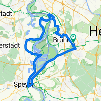
 Heidelberg/Ladenburg Rundkurs
- Distance
- 38.2 km
- Ascent
- 37 m
- Descent
- 38 m
- Location
- Schwetzingen, Baden-Wurttemberg, Germany
 L 543, Schwetzingen nach Geheimrat-Schott-Straße, Leimen
- Distance
- 16.3 km
- Ascent
- 57 m
- Descent
- 41 m
- Location
- Schwetzingen, Baden-Wurttemberg, Germany
 Luisenstraße 33, Schwetzingen nach Luisenstraße 35, Schwetzingen
- Distance
- 50 km
- Ascent
- 72 m
- Descent
- 73 m
- Location
- Schwetzingen, Baden-Wurttemberg, Germany
 kleine Altriprunde
- Distance
- 48.3 km
- Ascent
- 63 m
- Descent
- 68 m
- Location
- Schwetzingen, Baden-Wurttemberg, Germany
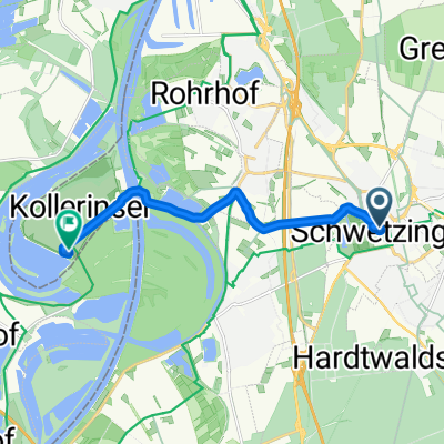 Schloßstraße nach Camping Kollersee
- Distance
- 9 km
- Ascent
- 16 m
- Descent
- 73 m
- Location
- Schwetzingen, Baden-Wurttemberg, Germany
Open it in the app