
CduSoleil tronc. I-06
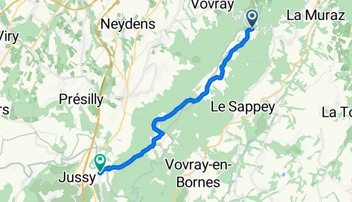
A cycling route starting in Collonges-sous-Salève, Auvergne-Rhône-Alpes, France.
Overview
About this route
The Paths of the Sun - Volume 1
- -:--
- Duration
- 10.8 km
- Distance
- 324 m
- Ascent
- 635 m
- Descent
- ---
- Avg. speed
- ---
- Max. altitude

Route quality
Waytypes & surfaces along the route
Waytypes
Path
6.1 km
(56 %)
Track
3.8 km
(35 %)
Surfaces
Paved
0.4 km
(4 %)
Unpaved
3.7 km
(34 %)
Ground
1.7 km
(16 %)
Gravel
1.5 km
(14 %)
Route highlights
Points of interest along the route
Photo after 4.5 km
Grand Piton du Salève 1.379m
Accommodation after 10.7 km
Inter Hotel Rey***, Mont Sion
Accommodation after 10.8 km
Gîte: Chez L'Odette
Continue with Bikemap
Use, edit, or download this cycling route
You would like to ride CduSoleil tronc. I-06 or customize it for your own trip? Here is what you can do with this Bikemap route:
Free features
- Save this route as favorite or in collections
- Copy & plan your own version of this route
- Sync your route with Garmin or Wahoo
Premium features
Free trial for 3 days, or one-time payment. More about Bikemap Premium.
- Navigate this route on iOS & Android
- Export a GPX / KML file of this route
- Create your custom printout (try it for free)
- Download this route for offline navigation
Discover more Premium features.
Get Bikemap PremiumFrom our community
Other popular routes starting in Collonges-sous-Salève
 2 climb Mountain loop 001 - Gusman
- Distance
- 179.8 km
- Ascent
- 2,276 m
- Descent
- 2,276 m
- Location
- Collonges-sous-Salève, Auvergne-Rhône-Alpes, France
 Hiking up Le Salève
- Distance
- 13.9 km
- Ascent
- 714 m
- Descent
- 712 m
- Location
- Collonges-sous-Salève, Auvergne-Rhône-Alpes, France
 Sortie enduro VAE / Saleve et Pt Saleve
- Distance
- 63 km
- Ascent
- 1,489 m
- Descent
- 1,501 m
- Location
- Collonges-sous-Salève, Auvergne-Rhône-Alpes, France
 Sentier géologique de la grotte d'Orjobet
- Distance
- 10.4 km
- Ascent
- 787 m
- Descent
- 780 m
- Location
- Collonges-sous-Salève, Auvergne-Rhône-Alpes, France
 Bouclette Genevois
- Distance
- 40 km
- Ascent
- 358 m
- Descent
- 376 m
- Location
- Collonges-sous-Salève, Auvergne-Rhône-Alpes, France
 Etape 1
- Distance
- 51.8 km
- Ascent
- 1,410 m
- Descent
- 1,072 m
- Location
- Collonges-sous-Salève, Auvergne-Rhône-Alpes, France
 kürzeste route nach basssyyy
- Distance
- 46.1 km
- Ascent
- 644 m
- Descent
- 1,149 m
- Location
- Collonges-sous-Salève, Auvergne-Rhône-Alpes, France
 saleve
- Distance
- 30.6 km
- Ascent
- 765 m
- Descent
- 774 m
- Location
- Collonges-sous-Salève, Auvergne-Rhône-Alpes, France
Open it in the app