

Tiengen - Courtenay, 2. Etappe
A cycling route starting in Langres, Grand Est, France.
Overview
About this route
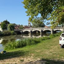
Point 6, still in the twilight, Caspar and I start the second section of our Mammuttour for the 30th anniversary of the football twinning. First on quieter departmental roads, but with long stretches of coarse surface.
- -:--
- Duration
- 231.2 km
- Distance
- 1,585 m
- Ascent
- 1,763 m
- Descent
- ---
- Avg. speed
- 468 m
- Max. altitude

Route quality
Waytypes & surfaces along the route
Waytypes
Quiet road
23.1 km
(10 %)
Track
23.1 km
(10 %)
Surfaces
Paved
92.5 km
(40 %)
Unpaved
16.2 km
(7 %)
Asphalt
92.5 km
(40 %)
Ground
9.2 km
(4 %)
Continue with Bikemap
Use, edit, or download this cycling route
You would like to ride Tiengen - Courtenay, 2. Etappe or customize it for your own trip? Here is what you can do with this Bikemap route:
Free features
- Save this route as favorite or in collections
- Copy & plan your own version of this route
- Split it into stages to create a multi-day tour
- Sync your route with Garmin or Wahoo
Premium features
Free trial for 3 days, or one-time payment. More about Bikemap Premium.
- Navigate this route on iOS & Android
- Export a GPX / KML file of this route
- Create your custom printout (try it for free)
- Download this route for offline navigation
Discover more Premium features.
Get Bikemap PremiumFrom our community
Other popular routes starting in Langres
 B 2019 E 5 var FF sud
- Distance
- 94.5 km
- Ascent
- 235 m
- Descent
- 460 m
- Location
- Langres, Grand Est, France
 Aadorf - Paris 6. Tag Langres - Vouécourt sur la Marne
- Distance
- 62.9 km
- Ascent
- 90 m
- Descent
- 323 m
- Location
- Langres, Grand Est, France
 Tiengen - Courtenay, 2. Etappe
- Distance
- 231.2 km
- Ascent
- 1,585 m
- Descent
- 1,763 m
- Location
- Langres, Grand Est, France
 2 Langres to Montelimar via Calon sur Saone, Macon, Lyon, Vienne & Valence
- Distance
- 525 km
- Ascent
- 154 m
- Descent
- 532 m
- Location
- Langres, Grand Est, France
 J3A REC2MIPIM 2018
- Distance
- 58.1 km
- Ascent
- 158 m
- Descent
- 385 m
- Location
- Langres, Grand Est, France
 11e Dag Tour de France 31-05-2022
- Distance
- 66.3 km
- Ascent
- 353 m
- Descent
- 612 m
- Location
- Langres, Grand Est, France
 Etape 6 / St geosmes _ Vesoul
- Distance
- 82.8 km
- Ascent
- 437 m
- Descent
- 738 m
- Location
- Langres, Grand Est, France
 Langres nach Neufchateau
- Distance
- 95.6 km
- Ascent
- 697 m
- Descent
- 877 m
- Location
- Langres, Grand Est, France
Open it in the app