

Kirchentellinsfurt (TÜ, RT) - Ulm über Radwege
A cycling route starting in Kirchentellinsfurt, Baden-Wurttemberg, Germany.
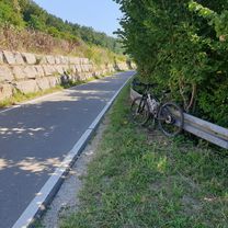
Overview
About this route
The route runs mainly on cycle paths and is also suitable for (experienced and disciplined) children from 10 years old. It requires some fitness and can be completed (with children) in about 7 hours. There are various refreshment stops since a number of villages are passed through. The ascent of the Alb is on a gravel track, the rest of the route is on paved roads. Near Römerstein and Blaubeuren, there are short stretches on the roadway.
- -:--
- Duration
- 96.6 km
- Distance
- 760 m
- Ascent
- 546 m
- Descent
- ---
- Avg. speed
- ---
- Max. altitude
Continue with Bikemap
Use, edit, or download this cycling route
You would like to ride Kirchentellinsfurt (TÜ, RT) - Ulm über Radwege or customize it for your own trip? Here is what you can do with this Bikemap route:
Free features
- Save this route as favorite or in collections
- Copy & plan your own version of this route
- Split it into stages to create a multi-day tour
- Sync your route with Garmin or Wahoo
Premium features
Free trial for 3 days, or one-time payment. More about Bikemap Premium.
- Navigate this route on iOS & Android
- Export a GPX / KML file of this route
- Create your custom printout (try it for free)
- Download this route for offline navigation
Discover more Premium features.
Get Bikemap PremiumFrom our community
Other popular routes starting in Kirchentellinsfurt
 Hill Reps Pfrondorf
- Distance
- 1.9 km
- Ascent
- 112 m
- Descent
- 32 m
- Location
- Kirchentellinsfurt, Baden-Wurttemberg, Germany
 K-Furt - Nebelhöle - K.Furt
- Distance
- 67.9 km
- Ascent
- 676 m
- Descent
- 675 m
- Location
- Kirchentellinsfurt, Baden-Wurttemberg, Germany
 Kirchentellinsfurt (TÜ, RT) - Ulm über Radwege
- Distance
- 96.6 km
- Ascent
- 760 m
- Descent
- 546 m
- Location
- Kirchentellinsfurt, Baden-Wurttemberg, Germany
 Tübingen - Tübingen
- Distance
- 11.7 km
- Ascent
- 211 m
- Descent
- 133 m
- Location
- Kirchentellinsfurt, Baden-Wurttemberg, Germany
 Kirchentellinsfurt (TÜ, RT) - Ulm über Radwege
- Distance
- 96.6 km
- Ascent
- 745 m
- Descent
- 535 m
- Location
- Kirchentellinsfurt, Baden-Wurttemberg, Germany
 Südliche Runde um Tübingen und zurück
- Distance
- 43.3 km
- Ascent
- 369 m
- Descent
- 372 m
- Location
- Kirchentellinsfurt, Baden-Wurttemberg, Germany
 B27, Kirchentellinsfurt nach Eichhaldestraße 157, Bad Urach
- Distance
- 29.7 km
- Ascent
- 166 m
- Descent
- 36 m
- Location
- Kirchentellinsfurt, Baden-Wurttemberg, Germany
 Gäu-Neckartal
- Distance
- 82 km
- Ascent
- 442 m
- Descent
- 426 m
- Location
- Kirchentellinsfurt, Baden-Wurttemberg, Germany
Open it in the app