

CduSoleil tronc. I-18
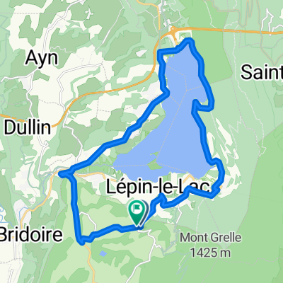
A cycling route starting in La Bridoire, Auvergne-Rhône-Alpes, France.
Overview
About this route
Les Chemins du Soleil - Tome 1
- -:--
- Duration
- 17.9 km
- Distance
- 802 m
- Ascent
- 795 m
- Descent
- ---
- Avg. speed
- ---
- Max. altitude

Route highlights
Points of interest along the route
Point of interest after 4.9 km
Belvédère du Mont Géle
Continue with Bikemap
Use, edit, or download this cycling route
You would like to ride CduSoleil tronc. I-18 or customize it for your own trip? Here is what you can do with this Bikemap route:
Free features
- Save this route as favorite or in collections
- Copy & plan your own version of this route
- Sync your route with Garmin or Wahoo
Premium features
Free trial for 3 days, or one-time payment. More about Bikemap Premium.
- Navigate this route on iOS & Android
- Export a GPX / KML file of this route
- Create your custom printout (try it for free)
- Download this route for offline navigation
Discover more Premium features.
Get Bikemap PremiumFrom our community
Other popular routes starting in La Bridoire
 CduSoleil tronc. I-18
- Distance
- 17.9 km
- Ascent
- 802 m
- Descent
- 795 m
- Location
- La Bridoire, Auvergne-Rhône-Alpes, France
 La Bageateriere-Val d'Isere - Grenoble - Albertville - Annecy - Chateaufort - Yenne - La Bageatiere 367km 2240hm
- Distance
- 366.5 km
- Ascent
- 3,070 m
- Descent
- 3,068 m
- Location
- La Bridoire, Auvergne-Rhône-Alpes, France
 Westalpen_8
- Distance
- 103.4 km
- Ascent
- 1,895 m
- Descent
- 1,400 m
- Location
- La Bridoire, Auvergne-Rhône-Alpes, France
 Par la Via Rhona
- Distance
- 70.1 km
- Ascent
- 739 m
- Descent
- 739 m
- Location
- La Bridoire, Auvergne-Rhône-Alpes, France
 lac novalaise 3
- Distance
- 19.9 km
- Ascent
- 259 m
- Descent
- 258 m
- Location
- La Bridoire, Auvergne-Rhône-Alpes, France
 Col de L'Epine (3e cat)
- Distance
- 37.9 km
- Ascent
- 864 m
- Descent
- 866 m
- Location
- La Bridoire, Auvergne-Rhône-Alpes, France
 Mont de Chat 1501+ (1e cat)
- Distance
- 45.3 km
- Ascent
- 1,393 m
- Descent
- 1,393 m
- Location
- La Bridoire, Auvergne-Rhône-Alpes, France
 Mon Tournier depuis la Bridoire
- Distance
- 57.2 km
- Ascent
- 1,052 m
- Descent
- 1,052 m
- Location
- La Bridoire, Auvergne-Rhône-Alpes, France
Open it in the app