

Tour des collines, Eymeux
A cycling route starting in Saint-Lattier, Auvergne-Rhône-Alpes, France.
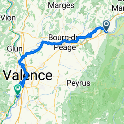
Overview
About this route
Montée de la mythique voie romaine au départ de St Lattier, c'est la seule difficulté.
Ensuite, c'est un enchaînement de coup de cul, single, sur des surfaces toutes différentes, de la route, en passant par le sable, la boue et les cailloux.
- -:--
- Duration
- 25.1 km
- Distance
- 545 m
- Ascent
- 545 m
- Descent
- ---
- Avg. speed
- ---
- Max. altitude

Continue with Bikemap
Use, edit, or download this cycling route
You would like to ride Tour des collines, Eymeux or customize it for your own trip? Here is what you can do with this Bikemap route:
Free features
- Save this route as favorite or in collections
- Copy & plan your own version of this route
- Sync your route with Garmin or Wahoo
Premium features
Free trial for 3 days, or one-time payment. More about Bikemap Premium.
- Navigate this route on iOS & Android
- Export a GPX / KML file of this route
- Create your custom printout (try it for free)
- Download this route for offline navigation
Discover more Premium features.
Get Bikemap PremiumFrom our community
Other popular routes starting in Saint-Lattier
 VERCORS
- Distance
- 101.8 km
- Ascent
- 1,692 m
- Descent
- 1,699 m
- Location
- Saint-Lattier, Auvergne-Rhône-Alpes, France
 Vercors
- Distance
- 160.4 km
- Ascent
- 2,589 m
- Descent
- 2,568 m
- Location
- Saint-Lattier, Auvergne-Rhône-Alpes, France
 Tour des collines, Eymeux
- Distance
- 7.1 km
- Ascent
- 191 m
- Descent
- 197 m
- Location
- Saint-Lattier, Auvergne-Rhône-Alpes, France
 De Le Village 1270, Saint-Lattier à Place de l'Église, Saint-Lattier
- Distance
- 34.9 km
- Ascent
- 1,455 m
- Descent
- 1,466 m
- Location
- Saint-Lattier, Auvergne-Rhône-Alpes, France
 Saint-Lattier - Soyons
- Distance
- 60.2 km
- Ascent
- 219 m
- Descent
- 302 m
- Location
- Saint-Lattier, Auvergne-Rhône-Alpes, France
 Tour des collines, Eymeux
- Distance
- 25.1 km
- Ascent
- 545 m
- Descent
- 545 m
- Location
- Saint-Lattier, Auvergne-Rhône-Alpes, France
 mon petit challenge du dauphiné
- Distance
- 110.1 km
- Ascent
- 1,876 m
- Descent
- 1,845 m
- Location
- Saint-Lattier, Auvergne-Rhône-Alpes, France
 COLLINE ET ISERE
- Distance
- 79.4 km
- Ascent
- 707 m
- Descent
- 715 m
- Location
- Saint-Lattier, Auvergne-Rhône-Alpes, France
Open it in the app