

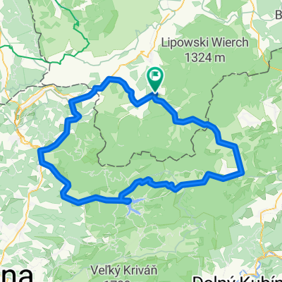
Beskidy Przegibek - Wielka Racza
A cycling route starting in Rajcza, Silesian Voivodeship, Poland.
Overview
About this route
Test of the Trek Liquid bike Route: Rajcza, Przegibek, Wielka Racza, Rycerka, Przegibek, Rycerzowa, Rajcza, Węgierska Górka
- -:--
- Duration
- 59.8 km
- Distance
- 1,445 m
- Ascent
- 1,472 m
- Descent
- ---
- Avg. speed
- ---
- Max. altitude

Continue with Bikemap
Use, edit, or download this cycling route
You would like to ride Beskidy Przegibek - Wielka Racza or customize it for your own trip? Here is what you can do with this Bikemap route:
Free features
- Save this route as favorite or in collections
- Copy & plan your own version of this route
- Sync your route with Garmin or Wahoo
Premium features
Free trial for 3 days, or one-time payment. More about Bikemap Premium.
- Navigate this route on iOS & Android
- Export a GPX / KML file of this route
- Create your custom printout (try it for free)
- Download this route for offline navigation
Discover more Premium features.
Get Bikemap PremiumFrom our community
Other popular routes starting in Rajcza
 Beskidy Przegibek - Wielka Racza
- Distance
- 59.8 km
- Ascent
- 1,445 m
- Descent
- 1,472 m
- Location
- Rajcza, Silesian Voivodeship, Poland
![Kralova hola [lolowy wyjazd:D]](https://media.bikemap.net/routes/812056/staticmaps/in_7217f928-85ca-4297-9d46-492f4b3d14dc_400x400_bikemap-2021-3D-static.png) Kralova hola [lolowy wyjazd:D]
Kralova hola [lolowy wyjazd:D]- Distance
- 329.5 km
- Ascent
- 3,475 m
- Descent
- 3,120 m
- Location
- Rajcza, Silesian Voivodeship, Poland
 Wokół Wielkiej Raczy i Rycerzowej
- Distance
- 107.6 km
- Ascent
- 1,097 m
- Descent
- 1,097 m
- Location
- Rajcza, Silesian Voivodeship, Poland
 Rajcza - Rycerzowa - Przegibek - Rajcza
- Distance
- 33.6 km
- Ascent
- 1,005 m
- Descent
- 1,003 m
- Location
- Rajcza, Silesian Voivodeship, Poland
 Rajcza, Hala Boracza, Hala Rysianka, Trzy kopce, Krawców Wierch, Rajcza
- Distance
- 36.5 km
- Ascent
- 1,210 m
- Descent
- 1,210 m
- Location
- Rajcza, Silesian Voivodeship, Poland
 Velo Soła
- Distance
- 44.4 km
- Ascent
- 260 m
- Descent
- 410 m
- Location
- Rajcza, Silesian Voivodeship, Poland
![RAJCZA TOUR`2011 plan trasy [6VIII]](https://media.bikemap.net/routes/1133459/staticmaps/in_ff24cec7-e7fd-4228-bdf1-b78e8fd397b5_400x400_bikemap-2021-3D-static.png) RAJCZA TOUR`2011 plan trasy [6VIII]
RAJCZA TOUR`2011 plan trasy [6VIII]- Distance
- 123 km
- Ascent
- 959 m
- Descent
- 960 m
- Location
- Rajcza, Silesian Voivodeship, Poland
 2018/18 Rajcza - Bystrická cyklomagistrála - Cyklotrasa 2434 - Glinka
- Distance
- 124.4 km
- Ascent
- 1,016 m
- Descent
- 1,016 m
- Location
- Rajcza, Silesian Voivodeship, Poland
Open it in the app