

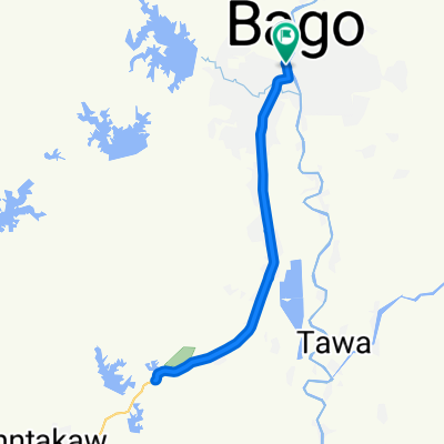
1T02 Kyaikhto
A cycling route starting in Bago, Bago Region, Myanmar.
Overview
About this route
Süd Ost Asien 2016, Etappe 1, Tag 02
Bago nach Kyaikhto- -:--
- Duration
- 95.9 km
- Distance
- 127 m
- Ascent
- 127 m
- Descent
- ---
- Avg. speed
- ---
- Max. altitude
Continue with Bikemap
Use, edit, or download this cycling route
You would like to ride 1T02 Kyaikhto or customize it for your own trip? Here is what you can do with this Bikemap route:
Free features
- Save this route as favorite or in collections
- Copy & plan your own version of this route
- Split it into stages to create a multi-day tour
- Sync your route with Garmin or Wahoo
Premium features
Free trial for 3 days, or one-time payment. More about Bikemap Premium.
- Navigate this route on iOS & Android
- Export a GPX / KML file of this route
- Create your custom printout (try it for free)
- Download this route for offline navigation
Discover more Premium features.
Get Bikemap PremiumFrom our community
Other popular routes starting in Bago
 Yangon - Mandalay Highway, Pegu to 8FFC+V2V, Bago
- Distance
- 6.1 km
- Ascent
- 44 m
- Descent
- 23 m
- Location
- Bago, Bago Region, Myanmar
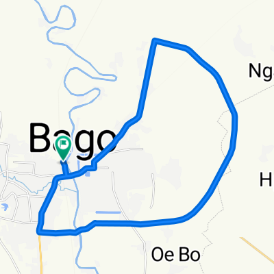
 Relaxed route
- Distance
- 30.6 km
- Ascent
- 126 m
- Descent
- 81 m
- Location
- Bago, Bago Region, Myanmar
 Daily
Daily- Distance
- 20.7 km
- Ascent
- 93 m
- Descent
- 94 m
- Location
- Bago, Bago Region, Myanmar
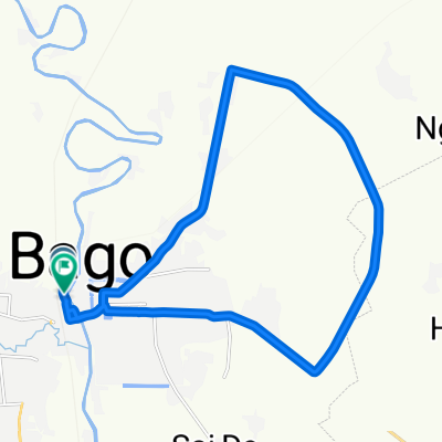
 Steady ride
- Distance
- 35.4 km
- Ascent
- 169 m
- Descent
- 114 m
- Location
- Bago, Bago Region, Myanmar
 Relaxed route
- Distance
- 30.5 km
- Ascent
- 123 m
- Descent
- 78 m
- Location
- Bago, Bago Region, Myanmar
 Steady ride
- Distance
- 26.6 km
- Ascent
- 78 m
- Descent
- 69 m
- Location
- Bago, Bago Region, Myanmar
 Bago-က်ိဳက္ပဒိုင္ (by Car)
- Distance
- 10 km
- Ascent
- 158 m
- Descent
- 112 m
- Location
- Bago, Bago Region, Myanmar
 MYA1_Süden
- Distance
- 332 km
- Ascent
- 839 m
- Descent
- 827 m
- Location
- Bago, Bago Region, Myanmar
Open it in the app