

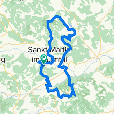
Ölspur Radtour 2003
A cycling route starting in Sankt Martin im Sulmtal, Styria, Austria.
Overview
About this route
7.09.2003 Net riding time: 4:01:37 Long ride
- -:--
- Duration
- 94.3 km
- Distance
- 578 m
- Ascent
- 578 m
- Descent
- ---
- Avg. speed
- ---
- Max. altitude

Continue with Bikemap
Use, edit, or download this cycling route
You would like to ride Ölspur Radtour 2003 or customize it for your own trip? Here is what you can do with this Bikemap route:
Free features
- Save this route as favorite or in collections
- Copy & plan your own version of this route
- Split it into stages to create a multi-day tour
- Sync your route with Garmin or Wahoo
Premium features
Free trial for 3 days, or one-time payment. More about Bikemap Premium.
- Navigate this route on iOS & Android
- Export a GPX / KML file of this route
- Create your custom printout (try it for free)
- Download this route for offline navigation
Discover more Premium features.
Get Bikemap PremiumFrom our community
Other popular routes starting in Sankt Martin im Sulmtal
 Dörfla 27, St. Martin im Sulmtal nach Badstraße, Pölfing-Brunn
- Distance
- 8.3 km
- Ascent
- 34 m
- Descent
- 48 m
- Location
- Sankt Martin im Sulmtal, Styria, Austria
 Otternitz _Kitzeck - Großklein - Otternitz
- Distance
- 52.3 km
- Ascent
- 527 m
- Descent
- 520 m
- Location
- Sankt Martin im Sulmtal, Styria, Austria
 Remschnigg Radlpass
- Distance
- 62.2 km
- Ascent
- 1,827 m
- Descent
- 1,768 m
- Location
- Sankt Martin im Sulmtal, Styria, Austria
 St. Martiner Wirtsleit' Genusstour
- Distance
- 33.1 km
- Ascent
- 554 m
- Descent
- 553 m
- Location
- Sankt Martin im Sulmtal, Styria, Austria
 Štýrské vinohrady - den čtvrtý
- Distance
- 38.1 km
- Ascent
- 310 m
- Descent
- 394 m
- Location
- Sankt Martin im Sulmtal, Styria, Austria
 Ölspur Radtour 2003
- Distance
- 94.3 km
- Ascent
- 578 m
- Descent
- 578 m
- Location
- Sankt Martin im Sulmtal, Styria, Austria
 Weinstrasse von Oternitz, Rückweg über Ehrenhausen und Sulmtal
- Distance
- 77.3 km
- Ascent
- 457 m
- Descent
- 457 m
- Location
- Sankt Martin im Sulmtal, Styria, Austria
 prelog
- Distance
- 336.8 km
- Ascent
- 612 m
- Descent
- 609 m
- Location
- Sankt Martin im Sulmtal, Styria, Austria
Open it in the app