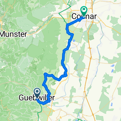
- 60.7 km
- 1,270 m
- 1,272 m
- Guebwiller, Grand Est, France
221 Von Mulhouse nach Mengen, Zug und Rad als Super-Kombination
A cycling route starting in Guebwiller, Grand Est, France.
Overview
About this route
Crossing old BORDERS!
By train to Mulhouse: e.g. 9:20 AM (2016) from Schallstadt station.
A few hours in the metropolis of Haut Alsace. Several museums, a great zoo, a beautiful old town, strolling along the Ill, an exotic weekly market with an oriental flair, ....
And then back in the afternoon warmth or heat through one of the largest French state forests and a Natura 2000 protected area, later over the Rhine, with the Black Forest in the evening light in front of us (if the weather is nice, smiling....)
- -:--
- Duration
- 51.6 km
- Distance
- 56 m
- Ascent
- 75 m
- Descent
- ---
- Avg. speed
- ---
- Max. altitude
created this 9 years ago
Route quality
Waytypes & surfaces along the route
Waytypes
Quiet road
14.4 km
(28 %)
Track
9.3 km
(18 %)
Surfaces
Paved
37.7 km
(73 %)
Unpaved
1.5 km
(3 %)
Asphalt
34.6 km
(67 %)
Paved (undefined)
3.1 km
(6 %)
Continue with Bikemap
Use, edit, or download this cycling route
You would like to ride 221 Von Mulhouse nach Mengen, Zug und Rad als Super-Kombination or customize it for your own trip? Here is what you can do with this Bikemap route:
Free features
- Save this route as favorite or in collections
- Copy & plan your own version of this route
- Sync your route with Garmin or Wahoo
Premium features
Free trial for 3 days, or one-time payment. More about Bikemap Premium.
- Navigate this route on iOS & Android
- Export a GPX / KML file of this route
- Create your custom printout (try it for free)
- Download this route for offline navigation
Discover more Premium features.
Get Bikemap PremiumFrom our community
Other popular routes starting in Guebwiller
- Florival Herrenabend Tour
- 04 - Circuit VTT de Judenhut
- 29.4 km
- 1,161 m
- 1,160 m
- Guebwiller, Grand Est, France
- 05 - Circuit VTT du Haag
- 39.3 km
- 1,479 m
- 1,478 m
- Guebwiller, Grand Est, France
- Vogesen_Samstag
- 33 km
- 1,417 m
- 1,418 m
- Guebwiller, Grand Est, France
- 06 - Circuit VTT de la Glashutte
- 41.8 km
- 1,619 m
- 1,617 m
- Guebwiller, Grand Est, France
- Elsass-Radtour Tag 5
- 48.5 km
- 290 m
- 275 m
- Guebwiller, Grand Est, France
- (Vogesen) Guebwiller - Grand Ballon - Wattwiller - Guebwiller
- 61.1 km
- 1,211 m
- 1,211 m
- Guebwiller, Grand Est, France
- From Guebwiller to Colmar
- 37.3 km
- 172 m
- 274 m
- Guebwiller, Grand Est, France
Open it in the app


