

Zschornewitz-Löbnitz
A cycling route starting in Zschornewitz, Saxony-Anhalt, Germany.
Overview
About this route
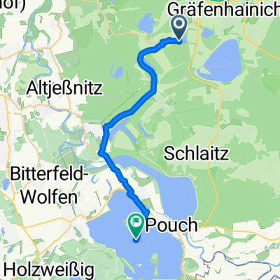
Zschornewitz-Bitterfeld (water gauge tower) - Löbnitz
- -:--
- Duration
- 28.3 km
- Distance
- 64 m
- Ascent
- 67 m
- Descent
- ---
- Avg. speed
- ---
- Max. altitude

Route quality
Waytypes & surfaces along the route
Waytypes
Track
12.2 km
(43 %)
Road
5.4 km
(19 %)
Surfaces
Paved
23 km
(81 %)
Unpaved
0.9 km
(3 %)
Asphalt
22.7 km
(80 %)
Ground
0.6 km
(2 %)
Continue with Bikemap
Use, edit, or download this cycling route
You would like to ride Zschornewitz-Löbnitz or customize it for your own trip? Here is what you can do with this Bikemap route:
Free features
- Save this route as favorite or in collections
- Copy & plan your own version of this route
- Sync your route with Garmin or Wahoo
Premium features
Free trial for 3 days, or one-time payment. More about Bikemap Premium.
- Navigate this route on iOS & Android
- Export a GPX / KML file of this route
- Create your custom printout (try it for free)
- Download this route for offline navigation
Discover more Premium features.
Get Bikemap PremiumFrom our community
Other popular routes starting in Zschornewitz
 GHC - Bad Schmiedeberg
- Distance
- 57.4 km
- Ascent
- 230 m
- Descent
- 232 m
- Location
- Zschornewitz, Saxony-Anhalt, Germany
 Zschornewitz-Löbnitz
- Distance
- 28.3 km
- Ascent
- 64 m
- Descent
- 67 m
- Location
- Zschornewitz, Saxony-Anhalt, Germany
 Ernst-Thälmann-Straße 22B, Gräfenhainichen nach Unnamed Road, Bitterfeld-Wolfen
- Distance
- 16.2 km
- Ascent
- 101 m
- Descent
- 116 m
- Location
- Zschornewitz, Saxony-Anhalt, Germany
 Ernst-Thälmann-Straße 22B, Gräfenhainichen nach PC-Straße 1, Bitterfeld-Wolfen
- Distance
- 17.7 km
- Ascent
- 39 m
- Descent
- 50 m
- Location
- Zschornewitz, Saxony-Anhalt, Germany
 Gurke am 14.2.21
- Distance
- 5.4 km
- Ascent
- 33 m
- Descent
- 33 m
- Location
- Zschornewitz, Saxony-Anhalt, Germany
 Kraftwerkstraße 9, Gräfenhainichen nach Lindenstraße 53, Kemberg
- Distance
- 20.1 km
- Ascent
- 31 m
- Descent
- 54 m
- Location
- Zschornewitz, Saxony-Anhalt, Germany
 Am Bahnhof 1–2, Gräfenhainichen nach Carl-von-Ossietzky-Straße 18, Gräfenhainichen
- Distance
- 7.9 km
- Ascent
- 0 m
- Descent
- 82 m
- Location
- Zschornewitz, Saxony-Anhalt, Germany
 Recovered Route
- Distance
- 1.9 km
- Ascent
- 13 m
- Descent
- 10 m
- Location
- Zschornewitz, Saxony-Anhalt, Germany
Open it in the app