

Tour de Suisse
A cycling route starting in Sargans, Canton of St. Gallen, Switzerland.
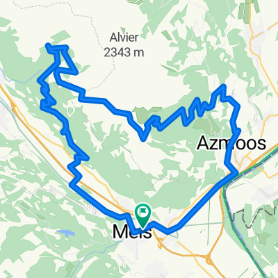
Overview
About this route
1 mal (fast) an der grenze der Schweiz entlang
- -:--
- Duration
- 1,203.2 km
- Distance
- 6,971 m
- Ascent
- 6,971 m
- Descent
- ---
- Avg. speed
- ---
- Max. altitude
Route quality
Waytypes & surfaces along the route
Waytypes
Quiet road
370.2 km
(31 %)
Busy road
295.6 km
(25 %)
Surfaces
Paved
862.1 km
(72 %)
Unpaved
124 km
(10 %)
Asphalt
809.8 km
(67 %)
Gravel
73.6 km
(6 %)
Continue with Bikemap
Use, edit, or download this cycling route
You would like to ride Tour de Suisse or customize it for your own trip? Here is what you can do with this Bikemap route:
Free features
- Save this route as favorite or in collections
- Copy & plan your own version of this route
- Split it into stages to create a multi-day tour
- Sync your route with Garmin or Wahoo
Premium features
Free trial for 3 days, or one-time payment. More about Bikemap Premium.
- Navigate this route on iOS & Android
- Export a GPX / KML file of this route
- Create your custom printout (try it for free)
- Download this route for offline navigation
Discover more Premium features.
Get Bikemap PremiumFrom our community
Other popular routes starting in Sargans
 Wangs Bad Ragaz Targön Schönbühl Wangs
- Distance
- 25.7 km
- Ascent
- 1,238 m
- Descent
- 1,188 m
- Location
- Sargans, Canton of St. Gallen, Switzerland
 batöni
- Distance
- 14.8 km
- Ascent
- 1,160 m
- Descent
- 196 m
- Location
- Sargans, Canton of St. Gallen, Switzerland
 Palfris
- Distance
- 44.4 km
- Ascent
- 1,340 m
- Descent
- 1,339 m
- Location
- Sargans, Canton of St. Gallen, Switzerland
 MOUNTAINBIKE-TOUR "FEIERABENDERLEBNIS"
- Distance
- 17 km
- Ascent
- 747 m
- Descent
- 737 m
- Location
- Sargans, Canton of St. Gallen, Switzerland
 Swiss Trekking 1
- Distance
- 19.2 km
- Ascent
- 1,457 m
- Descent
- 1,454 m
- Location
- Sargans, Canton of St. Gallen, Switzerland
 Sargans-Albula-St.Moritz 125km, 2950hm
- Distance
- 124.5 km
- Ascent
- 2,574 m
- Descent
- 1,216 m
- Location
- Sargans, Canton of St. Gallen, Switzerland
 Gonzen DH
- Distance
- 26.3 km
- Ascent
- 1,322 m
- Descent
- 1,320 m
- Location
- Sargans, Canton of St. Gallen, Switzerland
 TL CH 2021: 3. Tag Schwägalp
- Distance
- 142.3 km
- Ascent
- 1,873 m
- Descent
- 1,872 m
- Location
- Sargans, Canton of St. Gallen, Switzerland
Open it in the app