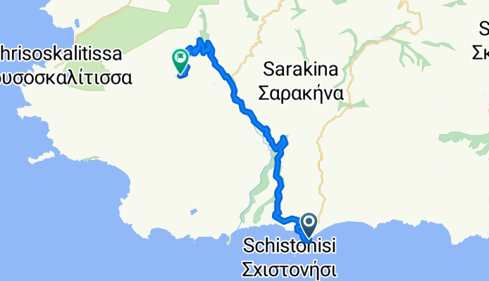
Paleochora - Voutas - Moustakos - Radarstation
A cycling route starting in Paleochora, Crete, Greece.
Overview
About this route
<div id="description_short_full" style="overflow: hidden; height: 282px;"> <span style="font-size: 10pt; font-family: "Times New Roman";">Charakteristik</span><span style="font-size: 10pt; font-family: "Times New Roman";">: Hauptsächlich asphaltierte Nebenstraßen, nach der Abzweigung nach Moustakos ein kurzes Stück schlechte Schotterstraße. Ab Moustakos sehr schmale aber relativ gute Asphaltstraße.</span>
<span style="font-size: 10pt; font-family: "Times New Roman";">Einkehrmöglichkeiten</span><span style="font-size: 10pt; font-family: "Times New Roman";">: Kafeneon in Voutas, Öffnungszeiten ungewiss, nicht darauf verlassen, scheint aber wieder belebter als noch vor einigen Jahren.</span>
<span style="font-size: 10pt; font-family: "Times New Roman";">Sehens- und Bemerkenswertes</span><span style="font-size: 10pt; font-family: "Times New Roman";">: große Kirche im Ort Voutas, atemberaubender Ausblick von der Radarstation. Laut Karte der Paleochora nächstgelegene Punkt auf über 1000 m der auf Straßen zu erreichen ist.</span> </div>
- -:--
- Duration
- 23.2 km
- Distance
- 1,264 m
- Ascent
- 395 m
- Descent
- ---
- Avg. speed
- 877 m
- Avg. speed
Route quality
Waytypes & surfaces along the route
Waytypes
Busy road
11.9 km
(51 %)
Quiet road
10.1 km
(43 %)
Surfaces
Paved
4.4 km
(19 %)
Unpaved
9.4 km
(40 %)
Gravel
9.4 km
(40 %)
Asphalt
3.9 km
(17 %)
Route highlights
Points of interest along the route

Point of interest after 15.6 km
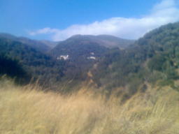
Blick auf Moustakos

Point of interest after 20.6 km
Blick Richtung Voutas
Continue with Bikemap
Use, edit, or download this cycling route
You would like to ride Paleochora - Voutas - Moustakos - Radarstation or customize it for your own trip? Here is what you can do with this Bikemap route:
Free features
- Save this route as favorite or in collections
- Copy & plan your own version of this route
- Sync your route with Garmin or Wahoo
Premium features
Free trial for 3 days, or one-time payment. More about Bikemap Premium.
- Navigate this route on iOS & Android
- Export a GPX / KML file of this route
- Create your custom printout (try it for free)
- Download this route for offline navigation
Discover more Premium features.
Get Bikemap PremiumFrom our community
Other popular routes starting in Paleochora
 Grammeno Camping - Matala
- Distance
- 181.3 km
- Ascent
- 1,968 m
- Descent
- 1,962 m
- Location
- Paleochora, Crete, Greece
 Paleochora - Azogires - Asfendiles - Platanes - Temenia - Kandanos - Paleochora
- Distance
- 45.3 km
- Ascent
- 1,603 m
- Descent
- 1,524 m
- Location
- Paleochora, Crete, Greece
 Rute 2
- Distance
- 35.4 km
- Ascent
- 1,172 m
- Descent
- 1,169 m
- Location
- Paleochora, Crete, Greece
 Kantanos Gorge - Paleochora
- Distance
- 37.1 km
- Ascent
- 177 m
- Descent
- 767 m
- Location
- Paleochora, Crete, Greece
 Anidri Schlucht Rundweg
- Distance
- 8.8 km
- Ascent
- 288 m
- Descent
- 280 m
- Location
- Paleochora, Crete, Greece
 Kreta Tag 6
- Distance
- 34.6 km
- Ascent
- 1,388 m
- Descent
- 1,339 m
- Location
- Paleochora, Crete, Greece
 Sougia to Palaechora 2012
- Distance
- 32.8 km
- Ascent
- 860 m
- Descent
- 867 m
- Location
- Paleochora, Crete, Greece
 test66_6
- Distance
- 70.1 km
- Ascent
- 1,511 m
- Descent
- 1,495 m
- Location
- Paleochora, Crete, Greece
Open it in the app

