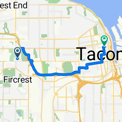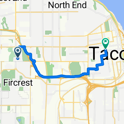
Route to 2nd Cycle Tacoma's Community Cycle Center
- 8.7 km
- 71 m
- 56 m
- Fircrest, Washington, United States
A cycling route starting in Fircrest, Washington, United States.
Overview
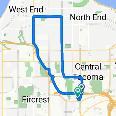
A nice 28 mile ride through UP/Tacoma waterfront areas. 1800 feet vertical ascent, but its pretty spreadout. There are however some awesome downhills, 40mph on a road bike. mtb hit 48mph - N30th, last mile of 5 mile drive, 6th Ave, several smaller hills in the waterfront area of UP. End with a quick 200 foot climb over a block to end.
This route keeps you pretty well out of traffic, at least the main arterials, except N 30th and Ruston. Make sure you have lights on your boike for the 51st street tunnel.
created this 16 years ago
Continue with Bikemap
You would like to ride UP/Tacoma waterfront ride....medium effort or customize it for your own trip? Here is what you can do with this Bikemap route:
Free trial for 3 days, or one-time payment. More about Bikemap Premium.
Discover more Premium features.
Get Bikemap PremiumFrom our community
Open it in the app