

.gpx
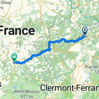
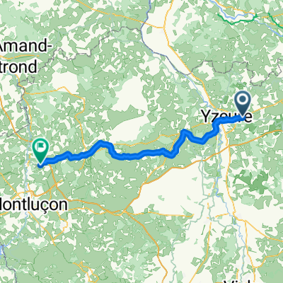
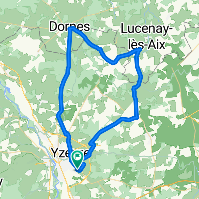
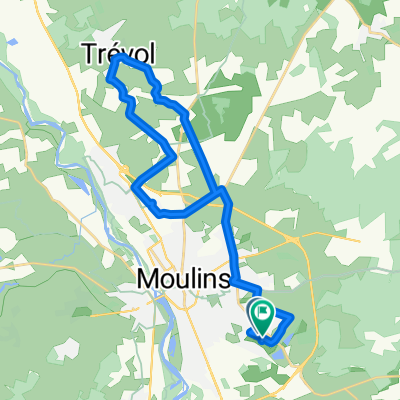
A cycling route starting in Yzeure, Auvergne-Rhône-Alpes, France.
Overview
About this route
Tour Description
- -:--
- Duration
- 40 km
- Distance
- 183 m
- Ascent
- 186 m
- Descent
- ---
- Avg. speed
- ---
- Max. altitude
Route quality
Waytypes & surfaces along the route
Waytypes
Quiet road
14.8 km
(37 %)
Road
12.4 km
(31 %)
Surfaces
Paved
7.6 km
(19 %)
Unpaved
0.8 km
(2 %)
Asphalt
7.2 km
(18 %)
Gravel
0.8 km
(2 %)
Route highlights
Points of interest along the route

Point of interest after 29.8 km
POI Description
Continue with Bikemap
Use, edit, or download this cycling route
You would like to ride .gpx or customize it for your own trip? Here is what you can do with this Bikemap route:
Free features
- Save this route as favorite or in collections
- Copy & plan your own version of this route
- Sync your route with Garmin or Wahoo
Premium features
Free trial for 3 days, or one-time payment. More about Bikemap Premium.
- Navigate this route on iOS & Android
- Export a GPX / KML file of this route
- Create your custom printout (try it for free)
- Download this route for offline navigation
Discover more Premium features.
Get Bikemap PremiumFrom our community
Other popular routes starting in Yzeure
 Paco 7
- Distance
- 173.2 km
- Ascent
- 1,820 m
- Descent
- 1,574 m
- Location
- Yzeure, Auvergne-Rhône-Alpes, France
 20170621_060924.gpx
- Distance
- 47.3 km
- Ascent
- 105 m
- Descent
- 105 m
- Location
- Yzeure, Auvergne-Rhône-Alpes, France
 Yzeure - Estivareilles
- Distance
- 78.6 km
- Ascent
- 798 m
- Descent
- 729 m
- Location
- Yzeure, Auvergne-Rhône-Alpes, France
 20170213_075616.gpx
- Distance
- 43 km
- Ascent
- 210 m
- Descent
- 210 m
- Location
- Yzeure, Auvergne-Rhône-Alpes, France
 20170307_090803.gpx
- Distance
- 31.7 km
- Ascent
- 110 m
- Descent
- 113 m
- Location
- Yzeure, Auvergne-Rhône-Alpes, France
 2020_E6_Moulins_Saint-Yorre
- Distance
- 82 km
- Ascent
- 664 m
- Descent
- 628 m
- Location
- Yzeure, Auvergne-Rhône-Alpes, France
 20170505_080054.gpx
- Distance
- 56.1 km
- Ascent
- 203 m
- Descent
- 206 m
- Location
- Yzeure, Auvergne-Rhône-Alpes, France
 20160109_090254.gpx
- Distance
- 28.2 km
- Ascent
- 126 m
- Descent
- 127 m
- Location
- Yzeure, Auvergne-Rhône-Alpes, France
Open it in the app