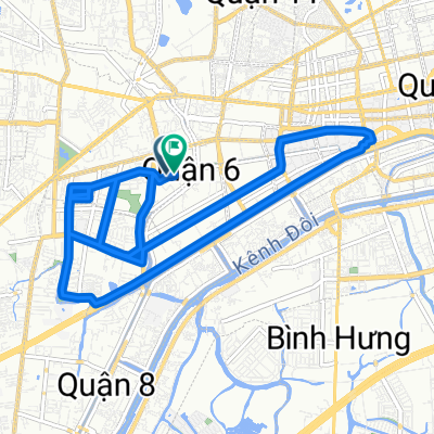
China Town to Binh Tay tourist area
- 8.9 km
- 16 m
- 14 m
- Quận Sáu, Ho Chi Minh City, Vietnam
A cycling route starting in Quận Sáu, Ho Chi Minh City, Vietnam.
Overview
Map from HCMC to Nam Cat Tien National Park to Dalat
created this 10 years ago
Continue with Bikemap
You would like to ride HCMC - Nam Cat Tien National Park - Dalat or customize it for your own trip? Here is what you can do with this Bikemap route:
Free trial for 3 days, or one-time payment. More about Bikemap Premium.
Discover more Premium features.
Get Bikemap PremiumFrom our community
Open it in the app