

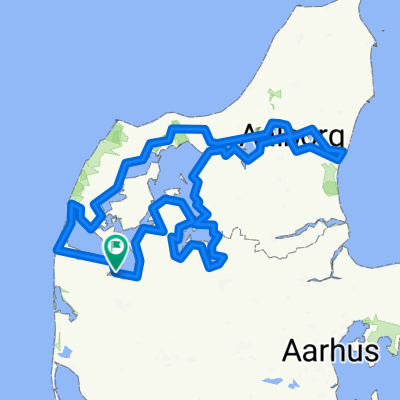
Asp til Fredrikshavn
A cycling route starting in Struer Municipality, Central Jutland, Denmark.
Overview
About this route
Fra Asp til Stena Line i Fredrikshavn
- -:--
- Duration
- 203.6 km
- Distance
- 248 m
- Ascent
- 287 m
- Descent
- ---
- Avg. speed
- ---
- Avg. speed
Route quality
Waytypes & surfaces along the route
Waytypes
Road
54 km
(27 %)
Quiet road
50.7 km
(25 %)
Surfaces
Paved
184.2 km
(90 %)
Unpaved
6.7 km
(3 %)
Asphalt
184 km
(90 %)
Gravel
6.1 km
(3 %)
Continue with Bikemap
Use, edit, or download this cycling route
You would like to ride Asp til Fredrikshavn or customize it for your own trip? Here is what you can do with this Bikemap route:
Free features
- Save this route as favorite or in collections
- Copy & plan your own version of this route
- Split it into stages to create a multi-day tour
- Sync your route with Garmin or Wahoo
Premium features
Free trial for 3 days, or one-time payment. More about Bikemap Premium.
- Navigate this route on iOS & Android
- Export a GPX / KML file of this route
- Create your custom printout (try it for free)
- Download this route for offline navigation
Discover more Premium features.
Get Bikemap PremiumFrom our community
Other popular routes starting in Struer Municipality
 Limfjorden rundt
- Distance
- 618.1 km
- Ascent
- 2,193 m
- Descent
- 2,193 m
- Location
- Struer Municipality, Central Jutland, Denmark
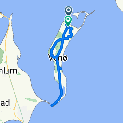 Venø - Cykelruterne på småøerne
- Distance
- 16.7 km
- Ascent
- ---
- Descent
- ---
- Location
- Struer Municipality, Central Jutland, Denmark
 Holstebro CC, JF
- Distance
- 25.1 km
- Ascent
- 80 m
- Descent
- 82 m
- Location
- Struer Municipality, Central Jutland, Denmark
 Rundt om Holstebro
- Distance
- 63.8 km
- Ascent
- 172 m
- Descent
- 172 m
- Location
- Struer Municipality, Central Jutland, Denmark
 Struer - Thisted
- Distance
- 77.6 km
- Ascent
- 418 m
- Descent
- 417 m
- Location
- Struer Municipality, Central Jutland, Denmark
 Venø havn-Klosterhede Plantage
- Distance
- 15.4 km
- Ascent
- 84 m
- Descent
- 42 m
- Location
- Struer Municipality, Central Jutland, Denmark
 Søndags tur
- Distance
- 138 km
- Ascent
- 302 m
- Descent
- 310 m
- Location
- Struer Municipality, Central Jutland, Denmark
 Post Danmark Rundt 2015 1.etape
- Distance
- 167.2 km
- Ascent
- 332 m
- Descent
- 315 m
- Location
- Struer Municipality, Central Jutland, Denmark
Open it in the app