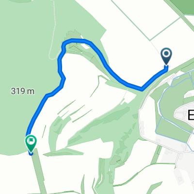
- 31 km
- 391 m
- 390 m
- Eußenheim, Bavaria, Germany
Přejezd Německa 27.7.2016
A cycling route starting in Eußenheim, Bavaria, Germany.
Overview
About this route
Previous - Next
Morning, fog, then cloudy. Very nice section Eussheim-Schweinfurt. Very nice town Zeil/Main, on the other hand Bamberg is a disappointment. Around Ebing corridor construction, overgrown with grass. At the end of the ordeal I couldn't find a place to sleep. After Bamberg terrible cycle path signage. Covered 143.29 km, 20.79 km/h.
- -:--
- Duration
- 138.8 km
- Distance
- 174 m
- Ascent
- 76 m
- Descent
- ---
- Avg. speed
- ---
- Max. altitude
created this 9 years ago
Route quality
Waytypes & surfaces along the route
Waytypes
Track
40.3 km
(29 %)
Path
40.3 km
(29 %)
Surfaces
Paved
112.4 km
(81 %)
Unpaved
6.9 km
(5 %)
Asphalt
91.6 km
(66 %)
Paved (undefined)
15.3 km
(11 %)
Route highlights
Points of interest along the route
Point of interest after 1.4 km
Snídaně - pekárna
Point of interest after 46.8 km
Oběd
Point of interest after 79.5 km
Káva
Point of interest after 110.3 km
Tady někde pivo
Accommodation after 138.8 km
Penzion Gruene Baum 34E se snídaní
Continue with Bikemap
Use, edit, or download this cycling route
You would like to ride Přejezd Německa 27.7.2016 or customize it for your own trip? Here is what you can do with this Bikemap route:
Free features
- Save this route as favorite or in collections
- Copy & plan your own version of this route
- Split it into stages to create a multi-day tour
- Sync your route with Garmin or Wahoo
Premium features
Free trial for 3 days, or one-time payment. More about Bikemap Premium.
- Navigate this route on iOS & Android
- Export a GPX / KML file of this route
- Create your custom printout (try it for free)
- Download this route for offline navigation
Discover more Premium features.
Get Bikemap PremiumFrom our community
Other popular routes starting in Eußenheim
- Bachgrund-Runde
- über Eußenheim und Gambach nach Wernfeld und zurück
- 31.6 km
- 361 m
- 361 m
- Eußenheim, Bavaria, Germany
- Wanderweg Nr. 25a Eußenheim-Aschfeld Bildstockwanderweg I verkürzte Variante
- 11 km
- 204 m
- 203 m
- Eußenheim, Bavaria, Germany
- Wanderweg Nr. 03 Eußenheim Dicke Eiche Nach der Fritsch Wanderkarte 88/Wanderkarte Eußenheim 2016
- 2 km
- 116 m
- 22 m
- Eußenheim, Bavaria, Germany
- Wanderweg Nr. 03a Eußenheim als Rundweg ab Dorfplatz zur Dicken Eiche
- 5.3 km
- 150 m
- 151 m
- Eußenheim, Bavaria, Germany
- eußenheim-karlstadt-wernfeld-bühler-eußenheim
- 37.3 km
- 185 m
- 177 m
- Eußenheim, Bavaria, Germany
- Přejezd Německa 27.7.2016
- 138.8 km
- 174 m
- 76 m
- Eußenheim, Bavaria, Germany
- Radtour Binsfeld Zellingen Karlstadt Eußenheim
- 40.3 km
- 388 m
- 388 m
- Eußenheim, Bavaria, Germany
Open it in the app


