J20 – Samedi 30 janvier 2016 – Cardenas – Villahermosa
A cycling route starting in Cárdenas, Tabasco, Mexico.
Overview
About this route
J20 – Samedi 30 janvier 2016 – Cardenas – Villahermosa
53,62 Kms – Moyenne 13,87 Kms/h Dénivelé montant 85 mètres – Pente Maxi 10% (sur 50 mètres à Villahermosa sinon presque plat) Dénivelé descendant 77 mètres – Pente Maxi 6% (à Villahermosa sinon presque plat)- -:--
- Duration
- 53.9 km
- Distance
- 30 m
- Ascent
- 48 m
- Descent
- ---
- Avg. speed
- ---
- Max. altitude
Continue with Bikemap
Use, edit, or download this cycling route
You would like to ride J20 – Samedi 30 janvier 2016 – Cardenas – Villahermosa or customize it for your own trip? Here is what you can do with this Bikemap route:
Free features
- Save this route as favorite or in collections
- Copy & plan your own version of this route
- Sync your route with Garmin or Wahoo
Premium features
Free trial for 3 days, or one-time payment. More about Bikemap Premium.
- Navigate this route on iOS & Android
- Export a GPX / KML file of this route
- Create your custom printout (try it for free)
- Download this route for offline navigation
Discover more Premium features.
Get Bikemap PremiumFrom our community
Other popular routes starting in Cárdenas
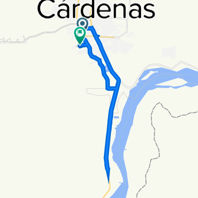
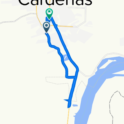
- Callejón de Los Jiménez, Huimanguillo a Carretera Malpaso - El Bellote, Huimanguillo
- Distance
- 19.2 km
- Ascent
- 3 m
- Descent
- 0 m
- Location
- Cárdenas, Tabasco, Mexico
- Recorded via Apple Watch - 02/11/21 20:25
- Distance
- 22.6 km
- Ascent
- 0 m
- Descent
- 0 m
- Location
- Cárdenas, Tabasco, Mexico
- J20 – Samedi 30 janvier 2016 – Cardenas – Villahermosa
- Distance
- 53.9 km
- Ascent
- 30 m
- Descent
- 48 m
- Location
- Cárdenas, Tabasco, Mexico
- De Calle Vía Láctea, Huimanguillo a Carretera Malpaso - El Bellote, Huimanguillo
- Distance
- 19.4 km
- Ascent
- 3 m
- Descent
- 0 m
- Location
- Cárdenas, Tabasco, Mexico
- ok limoncito
- Distance
- 39.7 km
- Ascent
- 28 m
- Descent
- 24 m
- Location
- Cárdenas, Tabasco, Mexico
- De Calle Vía Láctea, Huimanguillo a Andador Del Guaraguao 1–7, Cárdenas
- Distance
- 13.4 km
- Ascent
- 6 m
- Descent
- 5 m
- Location
- Cárdenas, Tabasco, Mexico
- Carretera Coatzacoalcos - Villahermosa, Cárdenas a Calle Vía Láctea, Huimanguillo
- Distance
- 7.7 km
- Ascent
- 8 m
- Descent
- 0 m
- Location
- Cárdenas, Tabasco, Mexico
- Calle Vía Láctea, Huimanguillo a Calle Vía Láctea, Huimanguillo
- Distance
- 70.4 km
- Ascent
- 208 m
- Descent
- 205 m
- Location
- Cárdenas, Tabasco, Mexico
Open it in the app