kurze Kaiserstuhlrunde
- 55.5 km
- 442 m
- 488 m
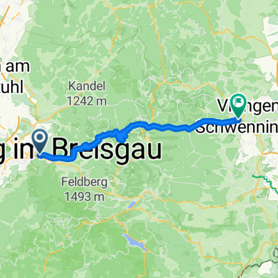
- Freiburg im Breisgau, Baden-Wurttemberg, Germany
A cycling route starting in Freiburg im Breisgau, Baden-Wurttemberg, Germany.
Overview
Freiburg - Staufen - Schauinsland (via Stohrenstraße (11.9% average!) - Oberried - Kirchzarten - Buchenbach - Thurner (via spirzenstraße) - St. Märgen - St. Peter - Stegen - Freiburg.
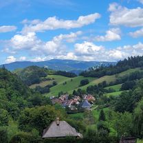
Two beautiful but also demanding mountain climbs and long sections with a slight gradient for high speeds...
created this 17 years ago
Route quality
Road
18.1 km
(18 %)
Path
10 km
(10 %)
Paved
89.4 km
(89 %)
Unpaved
6 km
(6 %)
Asphalt
87.4 km
(87 %)
Ground
4 km
(4 %)
Continue with Bikemap
You would like to ride Freiburger Bergetappe - Hochprozentiges or customize it for your own trip? Here is what you can do with this Bikemap route:
Free trial for 3 days, or one-time payment. More about Bikemap Premium.
Discover more Premium features.
Get Bikemap PremiumFrom our community
Open it in the app