

Trainingsrunde 25km Almbranz-Hof
A cycling route starting in Schauenstein, Bavaria, Germany.
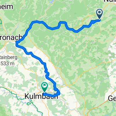
Overview
About this route
Alternative 50km Runde zur Trainingsrunde 90km Hof
- -:--
- Duration
- 24.1 km
- Distance
- 205 m
- Ascent
- 319 m
- Descent
- ---
- Avg. speed
- ---
- Max. altitude
Route quality
Waytypes & surfaces along the route
Waytypes
Track
11.4 km
(47 %)
Path
5.8 km
(24 %)
Surfaces
Paved
7 km
(29 %)
Unpaved
10.8 km
(45 %)
Asphalt
6.4 km
(27 %)
Gravel
4.8 km
(20 %)
Continue with Bikemap
Use, edit, or download this cycling route
You would like to ride Trainingsrunde 25km Almbranz-Hof or customize it for your own trip? Here is what you can do with this Bikemap route:
Free features
- Save this route as favorite or in collections
- Copy & plan your own version of this route
- Sync your route with Garmin or Wahoo
Premium features
Free trial for 3 days, or one-time payment. More about Bikemap Premium.
- Navigate this route on iOS & Android
- Export a GPX / KML file of this route
- Create your custom printout (try it for free)
- Download this route for offline navigation
Discover more Premium features.
Get Bikemap PremiumFrom our community
Other popular routes starting in Schauenstein
 Frankenwald
- Distance
- 20.8 km
- Ascent
- 320 m
- Descent
- 321 m
- Location
- Schauenstein, Bavaria, Germany
 von Schauenstein zum Untreusee
- Distance
- 34.5 km
- Ascent
- 361 m
- Descent
- 361 m
- Location
- Schauenstein, Bavaria, Germany
 Selbitz Realtour2
- Distance
- 54 km
- Ascent
- 550 m
- Descent
- 548 m
- Location
- Schauenstein, Bavaria, Germany
 Rund um den Döbraberg
- Distance
- 16.7 km
- Ascent
- 441 m
- Descent
- 441 m
- Location
- Schauenstein, Bavaria, Germany
 Trainingsrunde 25km Almbranz-Hof
- Distance
- 24.1 km
- Ascent
- 205 m
- Descent
- 319 m
- Location
- Schauenstein, Bavaria, Germany
 Schulstraße 10, Schauenstein nach Ringstraße 21, Schwarzenbach an der Saale
- Distance
- 17.3 km
- Ascent
- 272 m
- Descent
- 347 m
- Location
- Schauenstein, Bavaria, Germany
 Mountainbike Runde Döbraberg / Frankenwald
- Distance
- 48.1 km
- Ascent
- 1,054 m
- Descent
- 1,173 m
- Location
- Schauenstein, Bavaria, Germany
 Doebra_Vogtendorf_KU
- Distance
- 60 km
- Ascent
- 587 m
- Descent
- 975 m
- Location
- Schauenstein, Bavaria, Germany
Open it in the app