

28er MTB WDR-Runde
A cycling route starting in Sonnewalde, Brandenburg, Germany.
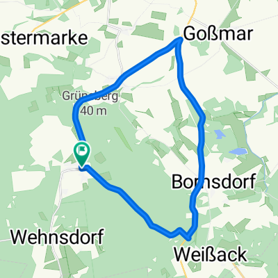
Overview
About this route
Bergtraining
(cloned from route 2373470)- -:--
- Duration
- 27.7 km
- Distance
- 319 m
- Ascent
- 319 m
- Descent
- ---
- Avg. speed
- ---
- Max. altitude

Route quality
Waytypes & surfaces along the route
Waytypes
Track
12.7 km
(46 %)
Quiet road
8.8 km
(32 %)
Surfaces
Paved
10.2 km
(37 %)
Unpaved
14.1 km
(51 %)
Asphalt
10.2 km
(37 %)
Gravel
6.1 km
(22 %)
Continue with Bikemap
Use, edit, or download this cycling route
You would like to ride 28er MTB WDR-Runde or customize it for your own trip? Here is what you can do with this Bikemap route:
Free features
- Save this route as favorite or in collections
- Copy & plan your own version of this route
- Sync your route with Garmin or Wahoo
Premium features
Free trial for 3 days, or one-time payment. More about Bikemap Premium.
- Navigate this route on iOS & Android
- Export a GPX / KML file of this route
- Create your custom printout (try it for free)
- Download this route for offline navigation
Discover more Premium features.
Get Bikemap PremiumFrom our community
Other popular routes starting in Sonnewalde
 Durch die Heide
- Distance
- 47.5 km
- Ascent
- 118 m
- Descent
- 149 m
- Location
- Sonnewalde, Brandenburg, Germany
 Durch die Niederlausitzer Heide 3
- Distance
- 37.7 km
- Ascent
- 62 m
- Descent
- 83 m
- Location
- Sonnewalde, Brandenburg, Germany
 Lausitzcup 1
- Distance
- 18.6 km
- Ascent
- 128 m
- Descent
- 128 m
- Location
- Sonnewalde, Brandenburg, Germany
 Zur Dahmequelle
- Distance
- 55.4 km
- Ascent
- 161 m
- Descent
- 216 m
- Location
- Sonnewalde, Brandenburg, Germany
 Foto-POIs Luckauer Land
- Distance
- 0.3 km
- Ascent
- 12 m
- Descent
- 0 m
- Location
- Sonnewalde, Brandenburg, Germany
 Recovered Route
- Distance
- 65 km
- Ascent
- 242 m
- Descent
- 223 m
- Location
- Sonnewalde, Brandenburg, Germany
 Baggerseen RR Tour mit Firlie
- Distance
- 90.9 km
- Ascent
- 242 m
- Descent
- 246 m
- Location
- Sonnewalde, Brandenburg, Germany
 Zeckerin - Lübben über Burg
- Distance
- 70.1 km
- Ascent
- 103 m
- Descent
- 158 m
- Location
- Sonnewalde, Brandenburg, Germany
Open it in the app