

R1a Wolbrom - Kraków-Krowodrza Górka
A cycling route starting in Wolbrom, Lesser Poland Voivodeship, Poland.
Overview
About this route
R1a Wolbrom - Tonie
The Wolbrom cycling route leads through very scenic terrain. It takes side roads to Skała, then passes through Ojców National Park and charming limestone valleys. From the perspective of efficient travel, a significant downside is the considerable proportion of gravel and dirt roads. From a sightseeing perspective, however, it is one of the best routes, with scenic values enhanced by substantial elevation changes. Due to difficulties in routing it along local roads near Skała, it runs for a two-kilometer section along provincial road 773.
-
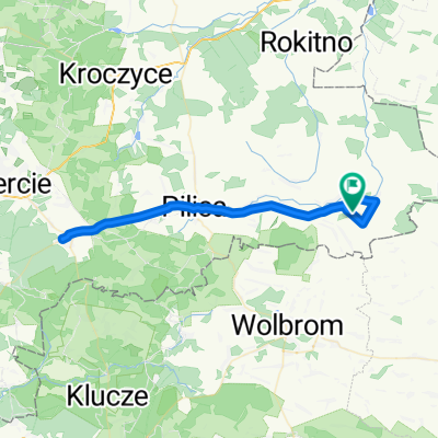
To Ojców. The route begins in Wolbrom, by the Church of the Exaltation of the Holy Cross. We ride uphill along Gołębia Street, then descend Norwida Street. At the intersection with Łukasińskiego Street, we turn right uphill. After 400m, turn left uphill, staying on the priority road. At the top, pass through the intersection straight ahead, heading down towards Sucha. After 1.5km, reach a three-way intersection with a very unusual right-of-way rule. Continue straight onto the subordinate road. After 1.7km, arrive at a yield sign and turn left. Cross Sucha, and after 2.5km pass straight through a four-way intersection in the middle of fields. After 1km, pass a subordinate road on the right, going straight ahead. After another 400m, turn right downhill. After 1.3km, the asphalt road ends and a field road begins. Ride through the valley; after 240m, turn right uphill. At the top, turn right onto an asphalt road (next to a post with hiking trail markings), pass a solitary house on the right and continue straight. Arrive at an intersection with a subordinate road, go straight uphill. After 700m, reach a STOP sign, continue straight. After 1.5km, turn left. Continue for 2.7km straight ahead, during which you exit the village of Milonki and enter Tarnawa. After 2.7km, turn right uphill; just beyond the intersection, pass a kindergarten on the left. For the next 4.9km, stay on the main road until nearly reaching Skała. Then the priority road turns left; we take a narrow road straight ahead, passing a roadside cross on the right. Then turn left and immediately right. Next, turn left onto Targowa Street, cross the marketplace diagonally and exit via Francesco Nullo Street (on market days, turn right and carefully cross the square). Enter the Market Square (which functions as a junction of provincial roads) and head along DW773 towards Wolbrom/Olkusz. WE STAY ON THE PROVINCIAL ROAD FOR 1.8 KM, then turn left off it towards Ojców. Follow the Prądnik valley to the center of Ojców.
-
To Tonie. Leave Ojców descending the Prądnik valley. Ride through the valley, reach an asphalt road until the intersection with the main road. Turn left and immediately right into Kwietniowe Doły Street. Ride onto a dirt path marked as a pedestrian-cyclist route. Ride through the forest, going uphill. Upon leaving the forest, the route turns left. Follow the road, turn right and reach the terminus of bus line 220. Arrive at the center of Giebułtów. Near the church, turn left and immediately right into Władysława Hermana Street. Descend, passing the cemetery on the left. After 1.2km, a 700m gravel road begins. Reach the end of the subordinate road, continue straight, stay on asphalt. Turn right onto Na Zielonki Street. Reach a 'Yield' sign and turn left, then immediately right.
-
Further riding. You can reach the center of Kraków via Łokietka Street. However, expect heavy car and pedestrian traffic in the city. If continuing deeper into the city, it's best to consult the Daroplan and the traffic restriction zones.
- -:--
- Duration
- 44 km
- Distance
- 280 m
- Ascent
- 440 m
- Descent
- ---
- Avg. speed
- ---
- Max. altitude

Route quality
Waytypes & surfaces along the route
Waytypes
Quiet road
26.4 km
(60 %)
Road
13.2 km
(30 %)
Surfaces
Paved
41 km
(93 %)
Unpaved
2.2 km
(5 %)
Asphalt
41 km
(93 %)
Gravel
1.3 km
(3 %)
Continue with Bikemap
Use, edit, or download this cycling route
You would like to ride R1a Wolbrom - Kraków-Krowodrza Górka or customize it for your own trip? Here is what you can do with this Bikemap route:
Free features
- Save this route as favorite or in collections
- Copy & plan your own version of this route
- Sync your route with Garmin or Wahoo
Premium features
Free trial for 3 days, or one-time payment. More about Bikemap Premium.
- Navigate this route on iOS & Android
- Export a GPX / KML file of this route
- Create your custom printout (try it for free)
- Download this route for offline navigation
Discover more Premium features.
Get Bikemap PremiumFrom our community
Other popular routes starting in Wolbrom
 wolbrom
- Distance
- 57.4 km
- Ascent
- 344 m
- Descent
- 487 m
- Location
- Wolbrom, Lesser Poland Voivodeship, Poland
 Chlina-Wolbrom-Chlina
- Distance
- 27 km
- Ascent
- 216 m
- Descent
- 218 m
- Location
- Wolbrom, Lesser Poland Voivodeship, Poland
 Wolbrom - Pieskowa Skała - Chrząstowice - Wolbrom
- Distance
- 44.4 km
- Ascent
- 376 m
- Descent
- 369 m
- Location
- Wolbrom, Lesser Poland Voivodeship, Poland
 Klonowa 9, Wolbrom do Klonowa 9, Wolbrom
- Distance
- 17.2 km
- Ascent
- 106 m
- Descent
- 109 m
- Location
- Wolbrom, Lesser Poland Voivodeship, Poland
 Niepogoda
- Distance
- 42.1 km
- Ascent
- 309 m
- Descent
- 308 m
- Location
- Wolbrom, Lesser Poland Voivodeship, Poland
 Gorąca noga !
- Distance
- 40.6 km
- Ascent
- 291 m
- Descent
- 291 m
- Location
- Wolbrom, Lesser Poland Voivodeship, Poland
 Chlina-Ogrodzieniec-Chlina
- Distance
- 52.9 km
- Ascent
- 279 m
- Descent
- 280 m
- Location
- Wolbrom, Lesser Poland Voivodeship, Poland
 R1a Wolbrom - Kraków-Krowodrza Górka
- Distance
- 44 km
- Ascent
- 280 m
- Descent
- 440 m
- Location
- Wolbrom, Lesser Poland Voivodeship, Poland
Open it in the app