

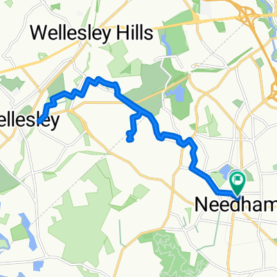
Needham/Dedham
A cycling route starting in Needham, Massachusetts, United States.
Overview
About this route
Warren Street south to High Rock, left, then out to Greendale Ave, over to Saint Sebastian's, then 135 into Dedham to Ames Street, then High Street? then home.
- -:--
- Duration
- 14.3 km
- Distance
- 122 m
- Ascent
- 122 m
- Descent
- ---
- Avg. speed
- ---
- Max. altitude
Route quality
Waytypes & surfaces along the route
Waytypes
Road
3.6 km
(25 %)
Quiet road
1.7 km
(12 %)
Surfaces
Paved
13.7 km
(96 %)
Asphalt
13.6 km
(95 %)
Paved (undefined)
0.1 km
(1 %)
Undefined
0.6 km
(4 %)
Continue with Bikemap
Use, edit, or download this cycling route
You would like to ride Needham/Dedham or customize it for your own trip? Here is what you can do with this Bikemap route:
Free features
- Save this route as favorite or in collections
- Copy & plan your own version of this route
- Sync your route with Garmin or Wahoo
Premium features
Free trial for 3 days, or one-time payment. More about Bikemap Premium.
- Navigate this route on iOS & Android
- Export a GPX / KML file of this route
- Create your custom printout (try it for free)
- Download this route for offline navigation
Discover more Premium features.
Get Bikemap PremiumFrom our community
Other popular routes starting in Needham
 1364 Great Plain Ave, Needham to 1234 Central Ave, Needham
- Distance
- 32.1 km
- Ascent
- 321 m
- Descent
- 303 m
- Location
- Needham, Massachusetts, United States
 700 Greendale Ave, Needham to RT-62, Concord
- Distance
- 27.9 km
- Ascent
- 204 m
- Descent
- 215 m
- Location
- Needham, Massachusetts, United States
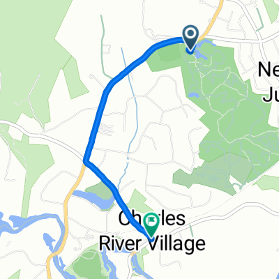 Route to 6 Charles River St, Needham
- Distance
- 2.6 km
- Ascent
- 35 m
- Descent
- 43 m
- Location
- Needham, Massachusetts, United States
 Chestnut Street 1122-1124, Newton to Chestnut St @ Pennsylvania Ave, Newton
- Distance
- 14.6 km
- Ascent
- 87 m
- Descent
- 56 m
- Location
- Needham, Massachusetts, United States
 38 Miles Home To Holliston
- Distance
- 62.2 km
- Ascent
- 318 m
- Descent
- 316 m
- Location
- Needham, Massachusetts, United States
 Adam training map #1 16 mi
- Distance
- 27.2 km
- Ascent
- 151 m
- Descent
- 151 m
- Location
- Needham, Massachusetts, United States
 bike mom rte 1
- Distance
- 16 km
- Ascent
- 135 m
- Descent
- 135 m
- Location
- Needham, Massachusetts, United States
 Needham
- Distance
- 62 km
- Ascent
- 331 m
- Descent
- 331 m
- Location
- Needham, Massachusetts, United States
Open it in the app