Rede bike - 20km
A cycling route starting in Astorga, Paraná, Brazil.
Overview
About this route
Rede bike - 20km e pontos de apoio
- -:--
- Duration
- 25.3 km
- Distance
- 289 m
- Ascent
- 289 m
- Descent
- ---
- Avg. speed
- ---
- Avg. speed
Route highlights
Points of interest along the route
Point of interest after 10.7 km
PC1 - Ponto de apoio e orientação
Point of interest after 14.7 km
PC2 - Ponto de apoio e orientação
Point of interest after 16.1 km
Ponto de orientação somente
Point of interest after 19.8 km
PC3 - Ponto de apoio e orientação
Continue with Bikemap
Use, edit, or download this cycling route
You would like to ride Rede bike - 20km or customize it for your own trip? Here is what you can do with this Bikemap route:
Free features
- Save this route as favorite or in collections
- Copy & plan your own version of this route
- Sync your route with Garmin or Wahoo
Premium features
Free trial for 3 days, or one-time payment. More about Bikemap Premium.
- Navigate this route on iOS & Android
- Export a GPX / KML file of this route
- Create your custom printout (try it for free)
- Download this route for offline navigation
Discover more Premium features.
Get Bikemap PremiumFrom our community
Other popular routes starting in Astorga
- ROTA BEIJA-FLOR
- Distance
- 34 km
- Ascent
- 394 m
- Descent
- 400 m
- Location
- Astorga, Paraná, Brazil
- ROTA PIPA
- Distance
- 31.7 km
- Ascent
- 341 m
- Descent
- 344 m
- Location
- Astorga, Paraná, Brazil
- PORTAL/BARRO PRETO
- Distance
- 31.1 km
- Ascent
- 361 m
- Descent
- 355 m
- Location
- Astorga, Paraná, Brazil
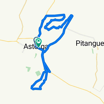
- ROTA SUSSUI/MOLICENTER
- Distance
- 46.7 km
- Ascent
- 401 m
- Descent
- 401 m
- Location
- Astorga, Paraná, Brazil
- Rede bike - 20km
- Distance
- 25.3 km
- Ascent
- 289 m
- Descent
- 289 m
- Location
- Astorga, Paraná, Brazil
- ROTA 600ALQ./ESTRADA S.JOSÉ
- Distance
- 33 km
- Ascent
- 349 m
- Descent
- 355 m
- Location
- Astorga, Paraná, Brazil
- ROTA FAZ.600/NIETO
- Distance
- 32.5 km
- Ascent
- 309 m
- Descent
- 317 m
- Location
- Astorga, Paraná, Brazil
- ROTA ECOLÓGICA FURTADO/CACHOEIRA
- Distance
- 33 km
- Ascent
- 403 m
- Descent
- 397 m
- Location
- Astorga, Paraná, Brazil
Open it in the app