

Route des Grandes Alpes stage 4
A cycling route starting in Val d'Isère, Auvergne-Rhône-Alpes, France.
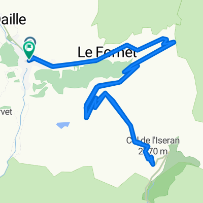
Overview
About this route
Lanslebourg to Briançon - via Col du Glaibier
- -:--
- Duration
- 115.2 km
- Distance
- 2,038 m
- Ascent
- 2,286 m
- Descent
- ---
- Avg. speed
- ---
- Max. altitude

Route quality
Waytypes & surfaces along the route
Waytypes
Road
5.8 km
(5 %)
Quiet road
3.5 km
(3 %)
Surfaces
Paved
96.7 km
(84 %)
Unpaved
1.2 km
(1 %)
Asphalt
96.7 km
(84 %)
Gravel
1.2 km
(1 %)
Undefined
17.3 km
(15 %)
Continue with Bikemap
Use, edit, or download this cycling route
You would like to ride Route des Grandes Alpes stage 4 or customize it for your own trip? Here is what you can do with this Bikemap route:
Free features
- Save this route as favorite or in collections
- Copy & plan your own version of this route
- Split it into stages to create a multi-day tour
- Sync your route with Garmin or Wahoo
Premium features
Free trial for 3 days, or one-time payment. More about Bikemap Premium.
- Navigate this route on iOS & Android
- Export a GPX / KML file of this route
- Create your custom printout (try it for free)
- Download this route for offline navigation
Discover more Premium features.
Get Bikemap PremiumFrom our community
Other popular routes starting in Val d'Isère
 Lanslevillard - Susa
- Distance
- 66.3 km
- Ascent
- 1,407 m
- Descent
- 2,382 m
- Location
- Val d'Isère, Auvergne-Rhône-Alpes, France
 Col de l'ISeran
- Distance
- 40.9 km
- Ascent
- 1,213 m
- Descent
- 1,209 m
- Location
- Val d'Isère, Auvergne-Rhône-Alpes, France
 Transalpine (12) Vijaron - St.Jean de Maurienne
- Distance
- 70.8 km
- Ascent
- 367 m
- Descent
- 1,553 m
- Location
- Val d'Isère, Auvergne-Rhône-Alpes, France
 Cols de Mont Cenis y Petit Mont Cenis
- Distance
- 47 km
- Ascent
- 1,108 m
- Descent
- 1,108 m
- Location
- Val d'Isère, Auvergne-Rhône-Alpes, France
 021 - 2014
- Distance
- 68.9 km
- Ascent
- 1,825 m
- Descent
- 2,036 m
- Location
- Val d'Isère, Auvergne-Rhône-Alpes, France
 Val D'Isere - Col d'Iseran - Col du Mont Cenis
- Distance
- 65.1 km
- Ascent
- 1,563 m
- Descent
- 1,917 m
- Location
- Val d'Isère, Auvergne-Rhône-Alpes, France
 RdGA Tag 4
- Distance
- 105.1 km
- Ascent
- 1,854 m
- Descent
- 2,275 m
- Location
- Val d'Isère, Auvergne-Rhône-Alpes, France
 Alpencross 2007/4 - Bessans bis Frais
- Distance
- 74.6 km
- Ascent
- 2,291 m
- Descent
- 2,502 m
- Location
- Val d'Isère, Auvergne-Rhône-Alpes, France
Open it in the app