

Stockholm - Dänemark Fähre
A cycling route starting in Stockholm, Stockholm County, Sweden.
Overview
About this route
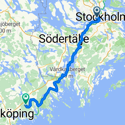
Stockholm via Copenhagen to the ferry at Rødbyhavn
- -:--
- Duration
- 894.8 km
- Distance
- 618 m
- Ascent
- 623 m
- Descent
- ---
- Avg. speed
- ---
- Max. altitude

Route quality
Waytypes & surfaces along the route
Waytypes
Road
331.1 km
(37 %)
Quiet road
143.2 km
(16 %)
Surfaces
Paved
724.8 km
(81 %)
Unpaved
53.7 km
(6 %)
Asphalt
653.2 km
(73 %)
Paved (undefined)
71.6 km
(8 %)
Continue with Bikemap
Use, edit, or download this cycling route
You would like to ride Stockholm - Dänemark Fähre or customize it for your own trip? Here is what you can do with this Bikemap route:
Free features
- Save this route as favorite or in collections
- Copy & plan your own version of this route
- Split it into stages to create a multi-day tour
- Sync your route with Garmin or Wahoo
Premium features
Free trial for 3 days, or one-time payment. More about Bikemap Premium.
- Navigate this route on iOS & Android
- Export a GPX / KML file of this route
- Create your custom printout (try it for free)
- Download this route for offline navigation
Discover more Premium features.
Get Bikemap PremiumFrom our community
Other popular routes starting in Stockholm
 Sztokhol
- Distance
- 18.7 km
- Ascent
- 172 m
- Descent
- 193 m
- Location
- Stockholm, Stockholm County, Sweden
 around the around
- Distance
- 27.4 km
- Ascent
- 267 m
- Descent
- 268 m
- Location
- Stockholm, Stockholm County, Sweden
 Loop to the West
- Distance
- 64.9 km
- Ascent
- 268 m
- Descent
- 266 m
- Location
- Stockholm, Stockholm County, Sweden
 Long bike tour from Stockholm to Märsta
- Distance
- 50.4 km
- Ascent
- 196 m
- Descent
- 208 m
- Location
- Stockholm, Stockholm County, Sweden
 Stockholm with Louise and James.
- Distance
- 14.9 km
- Ascent
- 193 m
- Descent
- 199 m
- Location
- Stockholm, Stockholm County, Sweden
 Olvofsgatan - Vaxholm
- Distance
- 43 km
- Ascent
- 207 m
- Descent
- 227 m
- Location
- Stockholm, Stockholm County, Sweden
 Stockholm - Nyköping
- Distance
- 111 km
- Ascent
- 1,160 m
- Descent
- 1,127 m
- Location
- Stockholm, Stockholm County, Sweden
 Kungsholmen-Brommaplan-Tappström
- Distance
- 19.7 km
- Ascent
- 166 m
- Descent
- 189 m
- Location
- Stockholm, Stockholm County, Sweden
Open it in the app