

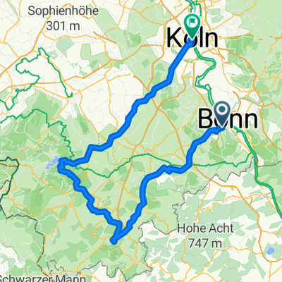
BRT2016-MI: In den Westerwald - PSF des Radsportbezirk Mittelrhein-Süd beim BRT 2016 in Bonn - 70 km Strecke
A cycling route starting in Bonn, North Rhine-Westphalia, Germany.
Overview
About this route
BRT2016-MI: In den Westerwald - 70 km
PSF (Pfeil-Such-Fahrt) des Radsportbezirk Mittelrhein-Süd beim BRT 2016 in Bonn
Alle weiteren Hinweise zu dieser Strecke -> hier anklicken
- -:--
- Duration
- 76.8 km
- Distance
- 561 m
- Ascent
- 561 m
- Descent
- ---
- Avg. speed
- ---
- Max. altitude

Route quality
Waytypes & surfaces along the route
Waytypes
Quiet road
28.8 km
(37 %)
Busy road
23.6 km
(31 %)
Surfaces
Paved
63.7 km
(83 %)
Unpaved
0.3 km
(<1 %)
Asphalt
61.7 km
(80 %)
Paving stones
1.5 km
(2 %)
Route highlights
Points of interest along the route
Point of interest after 16.5 km
Warum der Veranstalter hier keinen Warnhinweis vor der Passage aufgestellt hat, ist mir immer noch ein Rätsel.<br>Man kommt bei einer Schußfahrt mit gutem Belag in den Ort hineingerollt, hat 300 m bis zu einer Einmündung. Der Straßenbelag ist aber so schlecht, daß man selbst mit meinen Ballonreifen mit 10 km/h noch viel zu schnell unterwegs ist. 250 m Rüttelstrecke mit riesigen Schlaglöchern.

Drinking water after 22.7 km
Kontrolle <b>Hennef</b><br>wurde zweimal angesteuert
Continue with Bikemap
Use, edit, or download this cycling route
You would like to ride BRT2016-MI: In den Westerwald - PSF des Radsportbezirk Mittelrhein-Süd beim BRT 2016 in Bonn - 70 km Strecke or customize it for your own trip? Here is what you can do with this Bikemap route:
Free features
- Save this route as favorite or in collections
- Copy & plan your own version of this route
- Sync your route with Garmin or Wahoo
Premium features
Free trial for 3 days, or one-time payment. More about Bikemap Premium.
- Navigate this route on iOS & Android
- Export a GPX / KML file of this route
- Create your custom printout (try it for free)
- Download this route for offline navigation
Discover more Premium features.
Get Bikemap PremiumFrom our community
Other popular routes starting in Bonn
 BRT2016-FR: An Rhein und Sieg - PSF des Radsportbezirk Mittelrhein-Süd beim BRT 2016 in Bonn - 76 km Strecke
- Distance
- 74.9 km
- Ascent
- 509 m
- Descent
- 509 m
- Location
- Bonn, North Rhine-Westphalia, Germany
 BRT2016-FR: An Rhein und Sieg - RTF des Radsportbezirk Mittelrhein-Süd beim BRT 2016 in Bonn - 105 km Strecke einer Pfeil-Such-Fahrt
- Distance
- 104.9 km
- Ascent
- 1,022 m
- Descent
- 1,023 m
- Location
- Bonn, North Rhine-Westphalia, Germany
 Bonn - Stadt Blankenberg
- Distance
- 79.5 km
- Ascent
- 846 m
- Descent
- 846 m
- Location
- Bonn, North Rhine-Westphalia, Germany
 Ahrtal-Eifel-Kottenforst
- Distance
- 80.9 km
- Ascent
- 925 m
- Descent
- 910 m
- Location
- Bonn, North Rhine-Westphalia, Germany
 BRT2016-MI: In den Westerwald - PSF des Radsportbezirk Mittelrhein-Süd beim BRT 2016 in Bonn - 70 km Strecke
- Distance
- 76.8 km
- Ascent
- 561 m
- Descent
- 561 m
- Location
- Bonn, North Rhine-Westphalia, Germany
 Flach um Bonn
- Distance
- 56.6 km
- Ascent
- 186 m
- Descent
- 186 m
- Location
- Bonn, North Rhine-Westphalia, Germany
 Lockere 1Stunde rund und in Beuel
- Distance
- 21.3 km
- Ascent
- 182 m
- Descent
- 168 m
- Location
- Bonn, North Rhine-Westphalia, Germany
 Bonn - Ahrquelle - Rursee - Köln
- Distance
- 154 km
- Ascent
- 987 m
- Descent
- 1,006 m
- Location
- Bonn, North Rhine-Westphalia, Germany
Open it in the app