

BRT2016-SA: westwärts.. - RTF des Radsportbezirk Mittelrhein-Süd beim BRT 2016 in Bonn - 100 km Strecke einer Super-Pfeil-Such-Fahrt
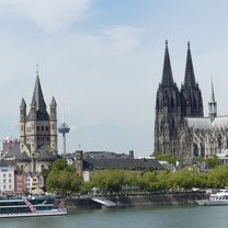
A cycling route starting in Bonn, North Rhine-Westphalia, Germany.
Overview
About this route
BRT2016-SA: westwards.. - 100 km
PSF (Pfeil-Such-Fahrt) of the Mittelrhein-Süd Cycling District at BRT 2016 in Bonn
Click here for all further information about this route
It is the culmination of a week-long event organized without enthusiasm, which thankfully ends today for all involved. The organizer apparently has had no interest since last Sunday.
- -:--
- Duration
- 100.8 km
- Distance
- 222 m
- Ascent
- 222 m
- Descent
- ---
- Avg. speed
- ---
- Max. altitude

Route quality
Waytypes & surfaces along the route
Waytypes
Quiet road
28.2 km
(28 %)
Road
22.2 km
(22 %)
Surfaces
Paved
77.6 km
(77 %)
Unpaved
1 km
(1 %)
Asphalt
72.6 km
(72 %)
Paved (undefined)
4 km
(4 %)
Route highlights
Points of interest along the route

Drinking water after 21.7 km
Kontrolle <b>Sechtem</b>

Drinking water after 54 km
Kontrolle <b>Frauenberg</b>

Drinking water after 78.3 km
Kontrolle <b>Flerzheim</b>
Continue with Bikemap
Use, edit, or download this cycling route
You would like to ride BRT2016-SA: westwärts.. - RTF des Radsportbezirk Mittelrhein-Süd beim BRT 2016 in Bonn - 100 km Strecke einer Super-Pfeil-Such-Fahrt or customize it for your own trip? Here is what you can do with this Bikemap route:
Free features
- Save this route as favorite or in collections
- Copy & plan your own version of this route
- Split it into stages to create a multi-day tour
- Sync your route with Garmin or Wahoo
Premium features
Free trial for 3 days, or one-time payment. More about Bikemap Premium.
- Navigate this route on iOS & Android
- Export a GPX / KML file of this route
- Create your custom printout (try it for free)
- Download this route for offline navigation
Discover more Premium features.
Get Bikemap PremiumFrom our community
Other popular routes starting in Bonn
 BRT2016-SA: westwärts.. - RTF des Radsportbezirk Mittelrhein-Süd beim BRT 2016 in Bonn - 100 km Strecke einer Super-Pfeil-Such-Fahrt
- Distance
- 100.8 km
- Ascent
- 222 m
- Descent
- 222 m
- Location
- Bonn, North Rhine-Westphalia, Germany
 Rund um Rheinbach und Todenfeld
- Distance
- 69.1 km
- Ascent
- 570 m
- Descent
- 530 m
- Location
- Bonn, North Rhine-Westphalia, Germany
 Siegtour
- Distance
- 44.5 km
- Ascent
- 173 m
- Descent
- 172 m
- Location
- Bonn, North Rhine-Westphalia, Germany
 Leichte MTB Abendrunde mit viel Abwechslung
- Distance
- 31.9 km
- Ascent
- 275 m
- Descent
- 281 m
- Location
- Bonn, North Rhine-Westphalia, Germany
 Venusbergtour 02
- Distance
- 17.5 km
- Ascent
- 289 m
- Descent
- 280 m
- Location
- Bonn, North Rhine-Westphalia, Germany
 BRT2016-DI: Ins Drachenfelser Ländchen - PSF des Radsportbezirk Mittelrhein-Süd beim BRT 2016 in Bonn - 71 km Strecke
- Distance
- 72.5 km
- Ascent
- 609 m
- Descent
- 610 m
- Location
- Bonn, North Rhine-Westphalia, Germany
 Ahrtal-Eifel-Kottenforst
- Distance
- 80.9 km
- Ascent
- 925 m
- Descent
- 910 m
- Location
- Bonn, North Rhine-Westphalia, Germany
 Von Troisdorf bis Köln und zurück
- Distance
- 70.2 km
- Ascent
- 231 m
- Descent
- 232 m
- Location
- Bonn, North Rhine-Westphalia, Germany
Open it in the app