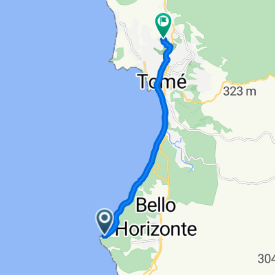
dichato menque tome dichato
A cycling route starting in Tomé, Región del Biobío, Chile.
Overview
About this route
camino que une dichato con menque, ranguelmo, rafael, tome y dichato
- -:--
- Duration
- 59.3 km
- Distance
- 891 m
- Ascent
- 891 m
- Descent
- ---
- Avg. speed
- ---
- Max. altitude
Route quality
Waytypes & surfaces along the route
Waytypes
Busy road
26.4 km
(45 %)
Road
23.9 km
(40 %)
Surfaces
Paved
34.2 km
(58 %)
Unpaved
24.3 km
(41 %)
Asphalt
28.4 km
(48 %)
Loose gravel
15.9 km
(27 %)
Continue with Bikemap
Use, edit, or download this cycling route
You would like to ride dichato menque tome dichato or customize it for your own trip? Here is what you can do with this Bikemap route:
Free features
- Save this route as favorite or in collections
- Copy & plan your own version of this route
- Sync your route with Garmin or Wahoo
Premium features
Free trial for 3 days, or one-time payment. More about Bikemap Premium.
- Navigate this route on iOS & Android
- Export a GPX / KML file of this route
- Create your custom printout (try it for free)
- Download this route for offline navigation
Discover more Premium features.
Get Bikemap PremiumFrom our community
Other popular routes starting in Tomé
- Ruta de alta velocidad
- Distance
- 5.1 km
- Ascent
- 142 m
- Descent
- 146 m
- Location
- Tomé, Región del Biobío, Chile
- Punta de Parra, Tomé a Enrique Molina, Tomé
- Distance
- 8.3 km
- Ascent
- 258 m
- Descent
- 137 m
- Location
- Tomé, Región del Biobío, Chile
- Playa Bellavista, Tomé a Enrique Molina 841, Tomé
- Distance
- 4.7 km
- Ascent
- 132 m
- Descent
- 23 m
- Location
- Tomé, Región del Biobío, Chile
- Acceso a Coliumo, Tomé a Pablo de Rokha, Tomé
- Distance
- 4.5 km
- Ascent
- 159 m
- Descent
- 56 m
- Location
- Tomé, Región del Biobío, Chile
- TOME-CONCEPCION
- Distance
- 27.7 km
- Ascent
- 383 m
- Descent
- 361 m
- Location
- Tomé, Región del Biobío, Chile
- Punta de Parra, Tomé a Maipú 1134–1180, Tomé
- Distance
- 7 km
- Ascent
- 166 m
- Descent
- 173 m
- Location
- Tomé, Región del Biobío, Chile
- Pingueral a vegas de Itata
- Distance
- 23.4 km
- Ascent
- 632 m
- Descent
- 662 m
- Location
- Tomé, Región del Biobío, Chile
- Paseo lento en Tomé
- Distance
- 7.6 km
- Ascent
- 0 m
- Descent
- 8 m
- Location
- Tomé, Región del Biobío, Chile
Open it in the app