
MTB - zur Sieg
A cycling route starting in Much, North Rhine-Westphalia, Germany.
Overview
About this route
challenging, only up and down, almost exclusively farm roads and singletrails; since not all paths are marked on the map, only a rough route guidance
- -:--
- Duration
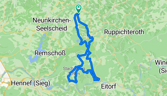
- 36.7 km
- Distance
- 688 m
- Ascent
- 688 m
- Descent
- ---
- Avg. speed
- ---
- Max. altitude

Continue with Bikemap
Use, edit, or download this cycling route
You would like to ride MTB - zur Sieg or customize it for your own trip? Here is what you can do with this Bikemap route:
Free features
- Save this route as favorite or in collections
- Copy & plan your own version of this route
- Sync your route with Garmin or Wahoo
Premium features
Free trial for 3 days, or one-time payment. More about Bikemap Premium.
- Navigate this route on iOS & Android
- Export a GPX / KML file of this route
- Create your custom printout (try it for free)
- Download this route for offline navigation
Discover more Premium features.
Get Bikemap PremiumFrom our community
Other popular routes starting in Much
 Jakobsweg-Drabenderhöhe-Denklingen
- Distance
- 41.2 km
- Ascent
- 538 m
- Descent
- 538 m
- Location
- Much, North Rhine-Westphalia, Germany
 2022_09_11^Wanderung Wennbach zur Mündung und zur Quelle zurück
- Distance
- 13.5 km
- Ascent
- 214 m
- Descent
- 213 m
- Location
- Much, North Rhine-Westphalia, Germany
 2025_04_26_nach Kurtenbach, feines Sonntagstouerchen mit Lisa
- Distance
- 33.8 km
- Ascent
- 517 m
- Descent
- 513 m
- Location
- Much, North Rhine-Westphalia, Germany
 E-bike-routenBergisch2-AufJaegersPfaden
- Distance
- 35.1 km
- Ascent
- 405 m
- Descent
- 403 m
- Location
- Much, North Rhine-Westphalia, Germany
 2025_05_01_BielsteinrundemitLisa
- Distance
- 47.1 km
- Ascent
- 661 m
- Descent
- 662 m
- Location
- Much, North Rhine-Westphalia, Germany
 Bielstein/Wiehl/Ruppi50
- Distance
- 52.7 km
- Ascent
- 594 m
- Descent
- 594 m
- Location
- Much, North Rhine-Westphalia, Germany
 Denklingen - Freudenberg - Wissen - Waldbröl
- Distance
- 131.5 km
- Ascent
- 896 m
- Descent
- 896 m
- Location
- Much, North Rhine-Westphalia, Germany
 MTB - zur Sieg
- Distance
- 36.7 km
- Ascent
- 688 m
- Descent
- 688 m
- Location
- Much, North Rhine-Westphalia, Germany
Open it in the app