

valliinrosamtb6
A cycling route starting in Merso di Sopra, Friuli Venezia Giulia, Italy.
Overview
About this route
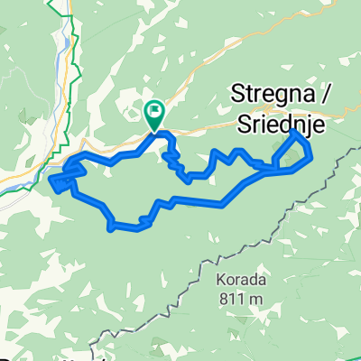
Da San Leonardo si procede in direzione del Monte Purgessimo, che una volta raggiunto si lascia percorrendo un bel sentiero che ci riconduce alla strada bianca principale. finita la strada bianca e raggiunto l'asfalto si prende a sinistra fino a giungere a Castelmonte. da qui si prosegue su asfalto fino al Trivio, per prendere in dirzione Tribil Inferiore.circa 2km prima del paese sulla destra si nota una tabella con sritto San Ivan, si prende la strada e si giunge a una bellissima chiesetta con un panorama mozzafiato. si prende il sentiero a destra e si arriva su alcuni paratoni con vista sul Matajur e il monte nero. Arrivati in paese si prende la strada per Planino poi Seuza, Altana e giù per un sentiero fino a San Leonardo
- -:--
- Duration
- 30.6 km
- Distance
- 687 m
- Ascent
- 687 m
- Descent
- ---
- Avg. speed
- ---
- Max. altitude

Route quality
Waytypes & surfaces along the route
Waytypes
Track
17.1 km
(56 %)
Road
8.5 km
(28 %)
Surfaces
Paved
1.3 km
(4 %)
Unpaved
17.2 km
(56 %)
Unpaved (undefined)
7.9 km
(26 %)
Gravel
7.3 km
(24 %)
Continue with Bikemap
Use, edit, or download this cycling route
You would like to ride valliinrosamtb6 or customize it for your own trip? Here is what you can do with this Bikemap route:
Free features
- Save this route as favorite or in collections
- Copy & plan your own version of this route
- Sync your route with Garmin or Wahoo
Premium features
Free trial for 3 days, or one-time payment. More about Bikemap Premium.
- Navigate this route on iOS & Android
- Export a GPX / KML file of this route
- Create your custom printout (try it for free)
- Download this route for offline navigation
Discover more Premium features.
Get Bikemap PremiumFrom our community
Other popular routes starting in Merso di Sopra
 San Leonardo - Tribil a
- Distance
- 34.5 km
- Ascent
- 848 m
- Descent
- 847 m
- Location
- Merso di Sopra, Friuli Venezia Giulia, Italy
 Natisone e-bike 2018
- Distance
- 45.7 km
- Ascent
- 655 m
- Descent
- 655 m
- Location
- Merso di Sopra, Friuli Venezia Giulia, Italy
 SanMartinoMau
- Distance
- 35.8 km
- Ascent
- 1,361 m
- Descent
- 1,361 m
- Location
- Merso di Sopra, Friuli Venezia Giulia, Italy
 San Martino
- Distance
- 25.4 km
- Ascent
- 619 m
- Descent
- 619 m
- Location
- Merso di Sopra, Friuli Venezia Giulia, Italy
 valliinrosamtb6
- Distance
- 30.6 km
- Ascent
- 687 m
- Descent
- 687 m
- Location
- Merso di Sopra, Friuli Venezia Giulia, Italy
 interpoderali 2016
- Distance
- 65.7 km
- Ascent
- 1,868 m
- Descent
- 1,866 m
- Location
- Merso di Sopra, Friuli Venezia Giulia, Italy
 cartina1 mtb "la panoramica"
- Distance
- 27 km
- Ascent
- 664 m
- Descent
- 664 m
- Location
- Merso di Sopra, Friuli Venezia Giulia, Italy
 e-bike valleys
- Distance
- 41.7 km
- Ascent
- 652 m
- Descent
- 652 m
- Location
- Merso di Sopra, Friuli Venezia Giulia, Italy
Open it in the app