

KDŠ_03_2018
A cycling route starting in Šenčur, Občina Šenčur, Slovenia.
Overview
About this route
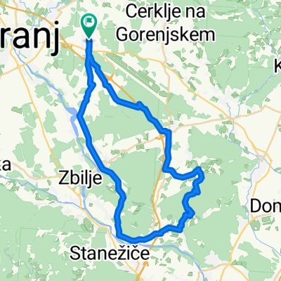
Šenčur - Luže - Visoko - Britof - Drulovka - Mavčiče - Zbilje - Ladja - Vaše - Medno - Vikrče - Pirniče - Valburga - Trboje - Voklo - Šenčur
- -:--
- Duration
- 44.8 km
- Distance
- 226 m
- Ascent
- 226 m
- Descent
- ---
- Avg. speed
- ---
- Max. altitude

Route quality
Waytypes & surfaces along the route
Waytypes
Road
20.6 km
(46 %)
Quiet road
15.7 km
(35 %)
Surfaces
Paved
27.3 km
(61 %)
Unpaved
3.1 km
(7 %)
Asphalt
26.4 km
(59 %)
Unpaved (undefined)
1.3 km
(3 %)
Continue with Bikemap
Use, edit, or download this cycling route
You would like to ride KDŠ_03_2018 or customize it for your own trip? Here is what you can do with this Bikemap route:
Free features
- Save this route as favorite or in collections
- Copy & plan your own version of this route
- Sync your route with Garmin or Wahoo
Premium features
Free trial for 3 days, or one-time payment. More about Bikemap Premium.
- Navigate this route on iOS & Android
- Export a GPX / KML file of this route
- Create your custom printout (try it for free)
- Download this route for offline navigation
Discover more Premium features.
Get Bikemap PremiumFrom our community
Other popular routes starting in Šenčur
 Kolesarjenje po občini šenčur
- Distance
- 25.5 km
- Ascent
- 104 m
- Descent
- 133 m
- Location
- Šenčur, Občina Šenčur, Slovenia
 Šenčur-strunjan
- Distance
- 155.4 km
- Ascent
- 1,651 m
- Descent
- 2,036 m
- Location
- Šenčur, Občina Šenčur, Slovenia
 KDŠ_11_2018
- Distance
- 44.5 km
- Ascent
- 233 m
- Descent
- 233 m
- Location
- Šenčur, Občina Šenčur, Slovenia
 zbilje - 2020
- Distance
- 37.4 km
- Ascent
- 105 m
- Descent
- 105 m
- Location
- Šenčur, Občina Šenčur, Slovenia
 KDŠ_27_2018
- Distance
- 42 km
- Ascent
- 379 m
- Descent
- 379 m
- Location
- Šenčur, Občina Šenčur, Slovenia
 LSD Day 1
- Distance
- 133.7 km
- Ascent
- 1,219 m
- Descent
- 1,450 m
- Location
- Šenčur, Občina Šenčur, Slovenia
 KDŠ_02_2018
- Distance
- 38.7 km
- Ascent
- 252 m
- Descent
- 255 m
- Location
- Šenčur, Občina Šenčur, Slovenia
 Čez Holmec
- Distance
- 202.3 km
- Ascent
- 3,228 m
- Descent
- 2,820 m
- Location
- Šenčur, Občina Šenčur, Slovenia
Open it in the app