

Holsteinische Schweiz -- von Eutin zum Bungsberg und zurück mit dem Mountainbike
A cycling route starting in Eutin, Schleswig-Holstein, Germany.
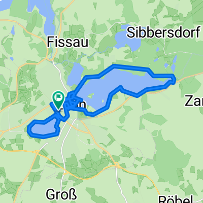
Overview
About this route
Wunderschöne Tour, die wirklich nur für Mountainbikes geeignet ist. Geht ganz schön rauf und runter. Als kröhnendes Ziel steht man dann auf dem Bungsberg mit 168m der höchste Berg Schleswig-Holsteins! Nach der Tour nach Zecken absuchen. Wir sind ein Stück neben dem Weg gefahren und hatten jeder 2 Stück! (Sommer 2013)
(cloned from route 2302270) (cloned from route 2750699)- -:--
- Duration
- 39.6 km
- Distance
- 266 m
- Ascent
- 269 m
- Descent
- ---
- Avg. speed
- ---
- Max. altitude
Route quality
Waytypes & surfaces along the route
Waytypes
Track
16.2 km
(41 %)
Quiet road
10.1 km
(26 %)
Surfaces
Paved
7.7 km
(20 %)
Unpaved
23.2 km
(59 %)
Gravel
12.7 km
(32 %)
Ground
8.6 km
(22 %)
Continue with Bikemap
Use, edit, or download this cycling route
You would like to ride Holsteinische Schweiz -- von Eutin zum Bungsberg und zurück mit dem Mountainbike or customize it for your own trip? Here is what you can do with this Bikemap route:
Free features
- Save this route as favorite or in collections
- Copy & plan your own version of this route
- Sync your route with Garmin or Wahoo
Premium features
Free trial for 3 days, or one-time payment. More about Bikemap Premium.
- Navigate this route on iOS & Android
- Export a GPX / KML file of this route
- Create your custom printout (try it for free)
- Download this route for offline navigation
Discover more Premium features.
Get Bikemap PremiumFrom our community
Other popular routes starting in Eutin
 Holsteinische Seen
- Distance
- 92.7 km
- Ascent
- 406 m
- Descent
- 410 m
- Location
- Eutin, Schleswig-Holstein, Germany
 Malente Bungsberg
- Distance
- 38.1 km
- Ascent
- 286 m
- Descent
- 287 m
- Location
- Eutin, Schleswig-Holstein, Germany
 Rund um die Eutiner Seen
- Distance
- 19.2 km
- Ascent
- 118 m
- Descent
- 121 m
- Location
- Eutin, Schleswig-Holstein, Germany
 Holsteinische-Schweiz-Radweg5
- Distance
- 199.8 km
- Ascent
- 1,303 m
- Descent
- 1,302 m
- Location
- Eutin, Schleswig-Holstein, Germany
 Matjesbrötchen in Sierksdorf
- Distance
- 49 km
- Ascent
- 149 m
- Descent
- 149 m
- Location
- Eutin, Schleswig-Holstein, Germany
 CTF Bungsberg 2009
- Distance
- 55.1 km
- Ascent
- 412 m
- Descent
- 362 m
- Location
- Eutin, Schleswig-Holstein, Germany
 Plöner See-Runde
- Distance
- 83 km
- Ascent
- 272 m
- Descent
- 272 m
- Location
- Eutin, Schleswig-Holstein, Germany
 Selenter See
- Distance
- 88.7 km
- Ascent
- 444 m
- Descent
- 439 m
- Location
- Eutin, Schleswig-Holstein, Germany
Open it in the app