

Houghall_Woods_run_#1
A cycling route starting in Durham, England, United Kingdom.
Overview
About this route
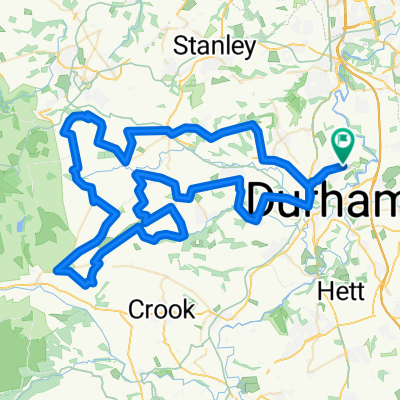
Mostly off-road run around Houghall Woods.
- -:--
- Duration
- 4.9 km
- Distance
- 105 m
- Ascent
- 104 m
- Descent
- ---
- Avg. speed
- ---
- Max. altitude

Continue with Bikemap
Use, edit, or download this cycling route
You would like to ride Houghall_Woods_run_#1 or customize it for your own trip? Here is what you can do with this Bikemap route:
Free features
- Save this route as favorite or in collections
- Copy & plan your own version of this route
- Sync your route with Garmin or Wahoo
Premium features
Free trial for 3 days, or one-time payment. More about Bikemap Premium.
- Navigate this route on iOS & Android
- Export a GPX / KML file of this route
- Create your custom printout (try it for free)
- Download this route for offline navigation
Discover more Premium features.
Get Bikemap PremiumFrom our community
Other popular routes starting in Durham
 Durham2Consett2Chester-le2Dru
- Distance
- 53.1 km
- Ascent
- 314 m
- Descent
- 304 m
- Location
- Durham, England, United Kingdom
 Houghall_Woods_run_#1
- Distance
- 4.9 km
- Ascent
- 105 m
- Descent
- 104 m
- Location
- Durham, England, United Kingdom
 A route I may attempt
- Distance
- 80.9 km
- Ascent
- 1,025 m
- Descent
- 1,023 m
- Location
- Durham, England, United Kingdom
 C2C Return pt1, from Durham-Sunderland-Durham
- Distance
- 65.1 km
- Ascent
- 281 m
- Descent
- 281 m
- Location
- Durham, England, United Kingdom
 bfcic 2022: DURHAM - YORK
- Distance
- 295 km
- Ascent
- 1,839 m
- Descent
- 1,905 m
- Location
- Durham, England, United Kingdom
 Durham to Langley Moor
- Distance
- 5.3 km
- Ascent
- 71 m
- Descent
- 50 m
- Location
- Durham, England, United Kingdom
 50mi hills
- Distance
- 85.5 km
- Ascent
- 1,026 m
- Descent
- 1,026 m
- Location
- Durham, England, United Kingdom
 My favorite cycling places in Durham
- Distance
- 21.3 km
- Ascent
- 206 m
- Descent
- 204 m
- Location
- Durham, England, United Kingdom
Open it in the app