

Drawskie
VVDrawskie-petla
A cycling route starting in Borne Sulinowo, West Pomeranian Voivodeship, Poland.
Overview
About this route
Borne Sulinowo - Kłomino - Borne Sulinowo
- -:--
- Duration
- 43 km
- Distance
- 91 m
- Ascent
- 92 m
- Descent
- ---
- Avg. speed
- ---
- Max. altitude

Part of
Drawskie
8 stages
Route quality
Waytypes & surfaces along the route
Waytypes
Track
17.3 km
(40 %)
Road
14.5 km
(34 %)
Surfaces
Paved
21.6 km
(50 %)
Unpaved
16.3 km
(38 %)
Asphalt
19.7 km
(46 %)
Gravel
9.5 km
(22 %)
Continue with Bikemap
Use, edit, or download this cycling route
You would like to ride VVDrawskie-petla or customize it for your own trip? Here is what you can do with this Bikemap route:
Free features
- Save this route as favorite or in collections
- Copy & plan your own version of this route
- Sync your route with Garmin or Wahoo
Premium features
Free trial for 3 days, or one-time payment. More about Bikemap Premium.
- Navigate this route on iOS & Android
- Export a GPX / KML file of this route
- Create your custom printout (try it for free)
- Download this route for offline navigation
Discover more Premium features.
Get Bikemap PremiumFrom our community
Other popular routes starting in Borne Sulinowo
 VVDrawskie-petla
- Distance
- 43 km
- Ascent
- 91 m
- Descent
- 92 m
- Location
- Borne Sulinowo, West Pomeranian Voivodeship, Poland
 Drawskie 3pętlatama
- Distance
- 23.6 km
- Ascent
- 92 m
- Descent
- 96 m
- Location
- Borne Sulinowo, West Pomeranian Voivodeship, Poland
 VVDrawskie-p
- Distance
- 44.4 km
- Ascent
- 84 m
- Descent
- 82 m
- Location
- Borne Sulinowo, West Pomeranian Voivodeship, Poland
 Naszyjnik Północy, Polanów-Drawsko Pomorskie - Czersk
- Distance
- 571.2 km
- Ascent
- 147 m
- Descent
- 176 m
- Location
- Borne Sulinowo, West Pomeranian Voivodeship, Poland
 Borne Sulinowo - Malbork
- Distance
- 218.1 km
- Ascent
- 253 m
- Descent
- 380 m
- Location
- Borne Sulinowo, West Pomeranian Voivodeship, Poland
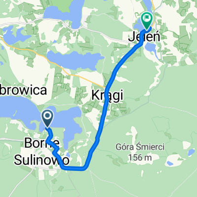 Jeziorna 9, Borne Sulinowo do Jeleń 27–31, Silnowo
- Distance
- 10.7 km
- Ascent
- 186 m
- Descent
- 178 m
- Location
- Borne Sulinowo, West Pomeranian Voivodeship, Poland
 Drawskie-pętlaN
- Distance
- 47.5 km
- Ascent
- 125 m
- Descent
- 125 m
- Location
- Borne Sulinowo, West Pomeranian Voivodeship, Poland
 Drawskie-5-2019
- Distance
- 43.3 km
- Ascent
- 118 m
- Descent
- 124 m
- Location
- Borne Sulinowo, West Pomeranian Voivodeship, Poland
Open it in the app