J.11. Entraygues sur Truyere - Figeac
A cycling route starting in Entraygues-sur-Truyère, Occitanie, France.
Overview
About this route
without Conques 71 km 1430 m elevation
Conques and back to the road 15 km 450 m more
Branch off shortly after Montarnal about 16 km 400 m more
- -:--
- Duration
- 85.6 km
- Distance
- 859 m
- Ascent
- 927 m
- Descent
- ---
- Avg. speed
- ---
- Max. altitude
Route quality
Waytypes & surfaces along the route
Waytypes
Road
18.8 km
(22 %)
Quiet road
14.6 km
(17 %)
Surfaces
Paved
45.4 km
(53 %)
Asphalt
45.4 km
(53 %)
Undefined
40.3 km
(47 %)
Continue with Bikemap
Use, edit, or download this cycling route
You would like to ride J.11. Entraygues sur Truyere - Figeac or customize it for your own trip? Here is what you can do with this Bikemap route:
Free features
- Save this route as favorite or in collections
- Copy & plan your own version of this route
- Split it into stages to create a multi-day tour
- Sync your route with Garmin or Wahoo
Premium features
Free trial for 3 days, or one-time payment. More about Bikemap Premium.
- Navigate this route on iOS & Android
- Export a GPX / KML file of this route
- Create your custom printout (try it for free)
- Download this route for offline navigation
Discover more Premium features.
Get Bikemap PremiumFrom our community
Other popular routes starting in Entraygues-sur-Truyère
- 4. Den (Těžká)
- Distance
- 70.6 km
- Ascent
- 1,031 m
- Descent
- 1,033 m
- Location
- Entraygues-sur-Truyère, Occitanie, France
- Aveyron-Tag7--3-0719 Runde angepasst
- Distance
- 124.3 km
- Ascent
- 1,859 m
- Descent
- 1,037 m
- Location
- Entraygues-sur-Truyère, Occitanie, France
- 5 Entraygues - Labenques
- Distance
- 127.4 km
- Ascent
- 690 m
- Descent
- 682 m
- Location
- Entraygues-sur-Truyère, Occitanie, France
- Golhinas-Conques-Nauviale
- Distance
- 38.9 km
- Ascent
- 815 m
- Descent
- 1,184 m
- Location
- Entraygues-sur-Truyère, Occitanie, France
- Saint-Amans-des-Cots Runde
- Distance
- 25.9 km
- Ascent
- 302 m
- Descent
- 307 m
- Location
- Entraygues-sur-Truyère, Occitanie, France
- Entraygues-sur-Truyere to St-Geniez d'Olt
- Distance
- 52.3 km
- Ascent
- 985 m
- Descent
- 712 m
- Location
- Entraygues-sur-Truyère, Occitanie, France
- Okzitanien_3b: Entraygues-sur-Truyère - Cajarc
- Distance
- 86.5 km
- Ascent
- 669 m
- Descent
- 753 m
- Location
- Entraygues-sur-Truyère, Occitanie, France
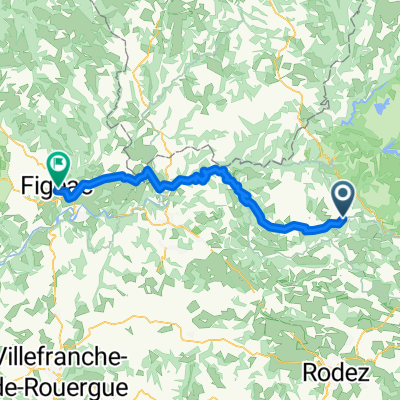
- Laucamp Entraigues Conques
- Distance
- 96.7 km
- Ascent
- 807 m
- Descent
- 809 m
- Location
- Entraygues-sur-Truyère, Occitanie, France
Open it in the app