

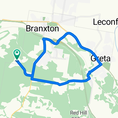
Hunter valley explore
A cycling route starting in Branxton, New South Wales, Australia.
Overview
About this route
Trying to find a safe route in the Hunter Valley
- -:--
- Duration
- 42.3 km
- Distance
- 375 m
- Ascent
- 363 m
- Descent
- ---
- Avg. speed
- ---
- Max. altitude
Route quality
Waytypes & surfaces along the route
Waytypes
Quiet road
22 km
(52 %)
Road
10.3 km
(24 %)
Surfaces
Paved
36 km
(85 %)
Unpaved
4.3 km
(10 %)
Asphalt
26.9 km
(64 %)
Paved (undefined)
8.3 km
(20 %)
Continue with Bikemap
Use, edit, or download this cycling route
You would like to ride Hunter valley explore or customize it for your own trip? Here is what you can do with this Bikemap route:
Free features
- Save this route as favorite or in collections
- Copy & plan your own version of this route
- Sync your route with Garmin or Wahoo
Premium features
Free trial for 3 days, or one-time payment. More about Bikemap Premium.
- Navigate this route on iOS & Android
- Export a GPX / KML file of this route
- Create your custom printout (try it for free)
- Download this route for offline navigation
Discover more Premium features.
Get Bikemap PremiumFrom our community
Other popular routes starting in Branxton
 Brango Greta loop
- Distance
- 17.4 km
- Ascent
- 198 m
- Descent
- 198 m
- Location
- Branxton, New South Wales, Australia
 afternoon ride
- Distance
- 23.9 km
- Ascent
- 246 m
- Descent
- 246 m
- Location
- Branxton, New South Wales, Australia
 Deasys Road, Rothbury to Mistletoe Lane 28, Pokolbin
- Distance
- 3.6 km
- Ascent
- 48 m
- Descent
- 14 m
- Location
- Branxton, New South Wales, Australia
 Hunter valley explore
- Distance
- 42.3 km
- Ascent
- 375 m
- Descent
- 363 m
- Location
- Branxton, New South Wales, Australia
 Branxton Greta loop
- Distance
- 18.9 km
- Ascent
- 186 m
- Descent
- 184 m
- Location
- Branxton, New South Wales, Australia
 14 Feb 2015 9:27 am
- Distance
- 52.9 km
- Ascent
- 350 m
- Descent
- 293 m
- Location
- Branxton, New South Wales, Australia
 Pokolbin to Hermitage Road 691, Pokolbin
- Distance
- 3.8 km
- Ascent
- 24 m
- Descent
- 17 m
- Location
- Branxton, New South Wales, Australia
 Mistletoe Lane, Pokolbin to Deasys Road 381, Pokolbin
- Distance
- 4.6 km
- Ascent
- 28 m
- Descent
- 61 m
- Location
- Branxton, New South Wales, Australia
Open it in the app