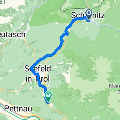
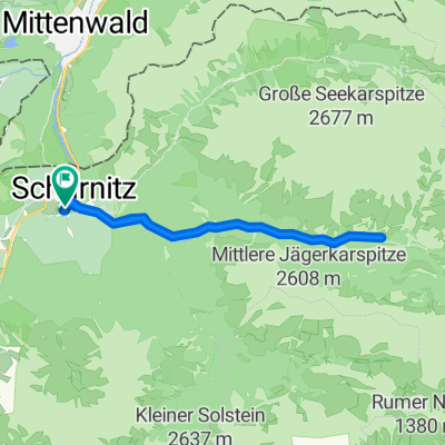
Isar-Ursprung
A cycling route starting in Scharnitz, Tyrol, Austria.
Overview
About this route
None (cloned from route 1152830)
(cloned from route 3414262)- -:--
- Duration
- 20.3 km
- Distance
- 863 m
- Ascent
- 66 m
- Descent
- ---
- Avg. speed
- ---
- Max. altitude
Continue with Bikemap
Use, edit, or download this cycling route
You would like to ride Isar-Ursprung or customize it for your own trip? Here is what you can do with this Bikemap route:
Free features
- Save this route as favorite or in collections
- Copy & plan your own version of this route
- Sync your route with Garmin or Wahoo
Premium features
Free trial for 3 days, or one-time payment. More about Bikemap Premium.
- Navigate this route on iOS & Android
- Export a GPX / KML file of this route
- Create your custom printout (try it for free)
- Download this route for offline navigation
Discover more Premium features.
Get Bikemap PremiumFrom our community
Other popular routes starting in Scharnitz
- Neuried zum Karwendelhaus und zurück
- Distance
- 248.6 km
- Ascent
- 3,146 m
- Descent
- 3,146 m
- Location
- Scharnitz, Tyrol, Austria
- Karwendeltal bis Karwendelhaus
- Distance
- 35.5 km
- Ascent
- 822 m
- Descent
- 822 m
- Location
- Scharnitz, Tyrol, Austria
- Karwendeldurchquerung
- Distance
- 66.5 km
- Ascent
- 1,520 m
- Descent
- 1,952 m
- Location
- Scharnitz, Tyrol, Austria
- cbm MTB-Tour Falkenhütte
- Distance
- 25.5 km
- Ascent
- 1,367 m
- Descent
- 575 m
- Location
- Scharnitz, Tyrol, Austria
- Gießenbach - Pfeishütte
- Distance
- 21.9 km
- Ascent
- 1,338 m
- Descent
- 446 m
- Location
- Scharnitz, Tyrol, Austria
- Karwendeltour 2009
- Distance
- 86.5 km
- Ascent
- 1,447 m
- Descent
- 1,843 m
- Location
- Scharnitz, Tyrol, Austria
- MiWA>Verona
- Distance
- 486.2 km
- Ascent
- 2,568 m
- Descent
- 3,507 m
- Location
- Scharnitz, Tyrol, Austria
- Oberbrunnalm / Möslalm
- Distance
- 29.3 km
- Ascent
- 762 m
- Descent
- 763 m
- Location
- Scharnitz, Tyrol, Austria
Open it in the app