

Doucier - Charbonnières
A cycling route starting in Clairvaux-les-Lacs, Bourgogne-Franche-Comté, France.
Overview
About this route
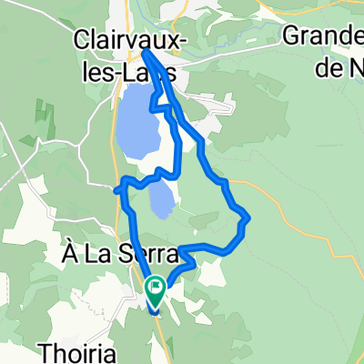
Lakes along the route to Mouthe over the Jura plateau to Charbonnières at Lac de Joux and Lac Brenet
- -:--
- Duration
- 62 km
- Distance
- 910 m
- Ascent
- 423 m
- Descent
- ---
- Avg. speed
- ---
- Max. altitude
Route quality
Waytypes & surfaces along the route
Waytypes
Road
16.7 km
(27 %)
Quiet road
3.1 km
(5 %)
Surfaces
Paved
32.2 km
(52 %)
Unpaved
3.1 km
(5 %)
Asphalt
32.2 km
(52 %)
Gravel
3.1 km
(5 %)
Undefined
26.6 km
(43 %)
Continue with Bikemap
Use, edit, or download this cycling route
You would like to ride Doucier - Charbonnières or customize it for your own trip? Here is what you can do with this Bikemap route:
Free features
- Save this route as favorite or in collections
- Copy & plan your own version of this route
- Sync your route with Garmin or Wahoo
Premium features
Free trial for 3 days, or one-time payment. More about Bikemap Premium.
- Navigate this route on iOS & Android
- Export a GPX / KML file of this route
- Create your custom printout (try it for free)
- Download this route for offline navigation
Discover more Premium features.
Get Bikemap PremiumFrom our community
Other popular routes starting in Clairvaux-les-Lacs
 Fr: Haute Jura
- Distance
- 88.7 km
- Ascent
- 1,400 m
- Descent
- 1,208 m
- Location
- Clairvaux-les-Lacs, Bourgogne-Franche-Comté, France
 Doucier rondje2
- Distance
- 55.1 km
- Ascent
- 1,067 m
- Descent
- 983 m
- Location
- Clairvaux-les-Lacs, Bourgogne-Franche-Comté, France
 Doucier - Charbonnières
- Distance
- 62 km
- Ascent
- 910 m
- Descent
- 423 m
- Location
- Clairvaux-les-Lacs, Bourgogne-Franche-Comté, France
 Les cascades du hérisson, Ilay, Grand Maclu, Petit Maclu, Narlay, Chalain
- Distance
- 36.8 km
- Ascent
- 939 m
- Descent
- 903 m
- Location
- Clairvaux-les-Lacs, Bourgogne-Franche-Comté, France
 Jura-Tour Eisessen
- Distance
- 95.3 km
- Ascent
- 967 m
- Descent
- 969 m
- Location
- Clairvaux-les-Lacs, Bourgogne-Franche-Comté, France
 De Route de Clairvaux 9, Soucia à Route de Clairvaux 9, Soucia
- Distance
- 12.5 km
- Ascent
- 139 m
- Descent
- 142 m
- Location
- Clairvaux-les-Lacs, Bourgogne-Franche-Comté, France
 Rondje L'Ain
- Distance
- 28.5 km
- Ascent
- 282 m
- Descent
- 282 m
- Location
- Clairvaux-les-Lacs, Bourgogne-Franche-Comté, France
 vtt clairvaux
- Distance
- 5.3 km
- Ascent
- 103 m
- Descent
- 101 m
- Location
- Clairvaux-les-Lacs, Bourgogne-Franche-Comté, France
Open it in the app