

17 Tag Port-de-Lanne - Saint-jean-Pied-de-Port
A cycling route starting in Peyrehorade, Nouvelle-Aquitaine, France.
Overview
About this route
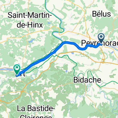
Tag 17 Port-de-Lanne Saint-Jean-Pied-de-Port
(cloned from route 3416897) (cloned from route 3416898) (cloned from route 3416902) (cloned from route 3416907) (cloned from route 3416912) (cloned from route 3416916) (cloned from route 3416921) (cloned from route 3416923) (cloned from route 3416927) (cloned from route 3416934) (cloned from route 3416937) (cloned from route 3417685) (cloned from route 3417688) (cloned from route 3417702) (cloned from route 3417722)- -:--
- Duration
- 72.1 km
- Distance
- 621 m
- Ascent
- 479 m
- Descent
- ---
- Avg. speed
- ---
- Max. altitude
Route quality
Waytypes & surfaces along the route
Waytypes
Road
29.2 km
(40 %)
Busy road
28.5 km
(40 %)
Surfaces
Paved
10.9 km
(15 %)
Asphalt
10.9 km
(15 %)
Wood
0 km
(<1 %)
Undefined
61.2 km
(85 %)
Continue with Bikemap
Use, edit, or download this cycling route
You would like to ride 17 Tag Port-de-Lanne - Saint-jean-Pied-de-Port or customize it for your own trip? Here is what you can do with this Bikemap route:
Free features
- Save this route as favorite or in collections
- Copy & plan your own version of this route
- Sync your route with Garmin or Wahoo
Premium features
Free trial for 3 days, or one-time payment. More about Bikemap Premium.
- Navigate this route on iOS & Android
- Export a GPX / KML file of this route
- Create your custom printout (try it for free)
- Download this route for offline navigation
Discover more Premium features.
Get Bikemap PremiumFrom our community
Other popular routes starting in Peyrehorade
 Etape 12-bis Port-de-Lanne - Saint-Palais
- Distance
- 40 km
- Ascent
- 504 m
- Descent
- 481 m
- Location
- Peyrehorade, Nouvelle-Aquitaine, France
 681 Route du Port, Port-de-Lanne à 1 Allée de Camouseigt, Bayonne
- Distance
- 35.3 km
- Ascent
- 188 m
- Descent
- 188 m
- Location
- Peyrehorade, Nouvelle-Aquitaine, France
 Sorde Labbaye-Hendaya
- Distance
- 86 km
- Ascent
- 308 m
- Descent
- 315 m
- Location
- Peyrehorade, Nouvelle-Aquitaine, France
 17 Tag Port-de-Lanne - Saint-jean-Pied-de-Port
- Distance
- 72.1 km
- Ascent
- 621 m
- Descent
- 479 m
- Location
- Peyrehorade, Nouvelle-Aquitaine, France
 jour 2 pau san sebastian
- Distance
- 110 km
- Ascent
- 921 m
- Descent
- 952 m
- Location
- Peyrehorade, Nouvelle-Aquitaine, France
 tour de Peyrehorade
- Distance
- 14.9 km
- Ascent
- 139 m
- Descent
- 139 m
- Location
- Peyrehorade, Nouvelle-Aquitaine, France
 Route d'Hastingues nach Allée de Mesples
- Distance
- 19.1 km
- Ascent
- 83 m
- Descent
- 49 m
- Location
- Peyrehorade, Nouvelle-Aquitaine, France
 De 165 Rue Juzan, Sorde-l'Abbaye à Rue de l'Église, Maslacq
- Distance
- 36.6 km
- Ascent
- 212 m
- Descent
- 146 m
- Location
- Peyrehorade, Nouvelle-Aquitaine, France
Open it in the app