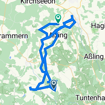
EBE Glonn Zinneberg + Steinsee Südtangente
A cycling route starting in Glonn, Bavaria, Germany.
Overview
About this route
... saved :)
- -:--
- Duration
- 16 km
- Distance
- 205 m
- Ascent
- 206 m
- Descent
- ---
- Avg. speed
- ---
- Max. altitude
Route quality
Waytypes & surfaces along the route
Waytypes
Track
8.6 km
(54 %)
Quiet road
4.2 km
(26 %)
Surfaces
Paved
6.4 km
(40 %)
Unpaved
9.1 km
(57 %)
Asphalt
6.1 km
(38 %)
Gravel
5.9 km
(37 %)
Continue with Bikemap
Use, edit, or download this cycling route
You would like to ride EBE Glonn Zinneberg + Steinsee Südtangente or customize it for your own trip? Here is what you can do with this Bikemap route:
Free features
- Save this route as favorite or in collections
- Copy & plan your own version of this route
- Sync your route with Garmin or Wahoo
Premium features
Free trial for 3 days, or one-time payment. More about Bikemap Premium.
- Navigate this route on iOS & Android
- Export a GPX / KML file of this route
- Create your custom printout (try it for free)
- Download this route for offline navigation
Discover more Premium features.
Get Bikemap PremiumFrom our community
Other popular routes starting in Glonn
- 18.6.23Bauernhof-Radltour
- Distance
- 89.4 km
- Ascent
- 1,132 m
- Descent
- 1,175 m
- Location
- Glonn, Bavaria, Germany
- Feierabendrunde:-)
- Distance
- 19.7 km
- Ascent
- 274 m
- Descent
- 274 m
- Location
- Glonn, Bavaria, Germany
- Rundkurs Aibling
- Distance
- 52.4 km
- Ascent
- 528 m
- Descent
- 516 m
- Location
- Glonn, Bavaria, Germany
- Glonn, Steinsee Aying und zurück.
- Distance
- 35.9 km
- Ascent
- 290 m
- Descent
- 291 m
- Location
- Glonn, Bavaria, Germany
- EBE Glonn Zinneberg + Steinsee Südtangente
- Distance
- 16 km
- Ascent
- 205 m
- Descent
- 206 m
- Location
- Glonn, Bavaria, Germany
- Schießstätte 9, Glonn über Reisenthal nach Ottobrunn
- Distance
- 25.5 km
- Ascent
- 259 m
- Descent
- 305 m
- Location
- Glonn, Bavaria, Germany
- Sonntags nach Weyarn:-)
- Distance
- 42.3 km
- Ascent
- 432 m
- Descent
- 432 m
- Location
- Glonn, Bavaria, Germany
- Sonntags über Antohling nach Bruckmühl, an der Mangfall zurück.
- Distance
- 43.2 km
- Ascent
- 291 m
- Descent
- 291 m
- Location
- Glonn, Bavaria, Germany
Open it in the app