

Main-Radweg – aus Trekkingbike 5/2012 - editiert 2
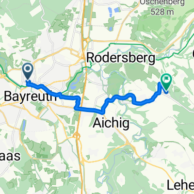
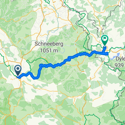
A cycling route starting in Bayreuth, Bavaria, Germany.
Overview
About this route
Based on a GPX from Trekkingbike, this route has been adapted to our needs. The route is to be ridden in the fall of 2016.
- -:--
- Duration
- 519.1 km
- Distance
- 167 m
- Ascent
- 411 m
- Descent
- ---
- Avg. speed
- ---
- Max. altitude

Route quality
Waytypes & surfaces along the route
Waytypes
Path
181.7 km
(35 %)
Quiet road
103.8 km
(20 %)
Surfaces
Paved
472.4 km
(91 %)
Unpaved
15.6 km
(3 %)
Asphalt
456.8 km
(88 %)
Concrete
10.4 km
(2 %)
Route highlights
Points of interest along the route
Point of interest after 58.2 km
Continue with Bikemap
Use, edit, or download this cycling route
You would like to ride Main-Radweg – aus Trekkingbike 5/2012 - editiert 2 or customize it for your own trip? Here is what you can do with this Bikemap route:
Free features
- Save this route as favorite or in collections
- Copy & plan your own version of this route
- Split it into stages to create a multi-day tour
- Sync your route with Garmin or Wahoo
Premium features
Free trial for 3 days, or one-time payment. More about Bikemap Premium.
- Navigate this route on iOS & Android
- Export a GPX / KML file of this route
- Create your custom printout (try it for free)
- Download this route for offline navigation
Discover more Premium features.
Get Bikemap PremiumFrom our community
Other popular routes starting in Bayreuth
 Bayreuth, Bindlach, Bayreuth
- Distance
- 18.9 km
- Ascent
- 200 m
- Descent
- 197 m
- Location
- Bayreuth, Bavaria, Germany
 Route in Bayreuth
- Distance
- 8.6 km
- Ascent
- 157 m
- Descent
- 40 m
- Location
- Bayreuth, Bavaria, Germany
 Route im Schneckentempo in Bayreuth
- Distance
- 23.1 km
- Ascent
- 585 m
- Descent
- 547 m
- Location
- Bayreuth, Bavaria, Germany
 Main-Radweg – aus Trekkingbike 5/2012 - editiert 2
- Distance
- 519.1 km
- Ascent
- 167 m
- Descent
- 411 m
- Location
- Bayreuth, Bavaria, Germany
 Rund um Bayreuth
- Distance
- 37.7 km
- Ascent
- 240 m
- Descent
- 249 m
- Location
- Bayreuth, Bavaria, Germany
 Oschenberg inkl. Arschkerbe
- Distance
- 24.8 km
- Ascent
- 306 m
- Descent
- 307 m
- Location
- Bayreuth, Bavaria, Germany
 Von Bayreuth bis Eger
- Distance
- 93.2 km
- Ascent
- 1,167 m
- Descent
- 1,069 m
- Location
- Bayreuth, Bavaria, Germany
 Unbenannte Route
- Distance
- 190.2 km
- Ascent
- 919 m
- Descent
- 1,061 m
- Location
- Bayreuth, Bavaria, Germany
Open it in the app