

F.enV. day 3 2016 131km 1300m
A cycling route starting in Gramat, Occitanie, France.
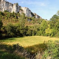
Overview
About this route
Souillac to Chateau le Fleunie Condat-sur-Vezere
- -:--
- Duration
- 131.4 km
- Distance
- 710 m
- Ascent
- 927 m
- Descent
- ---
- Avg. speed
- ---
- Max. altitude
Route quality
Waytypes & surfaces along the route
Waytypes
Road
25 km
(19 %)
Quiet road
9.2 km
(7 %)
Surfaces
Paved
82.8 km
(63 %)
Asphalt
82.8 km
(63 %)
Undefined
48.6 km
(37 %)
Continue with Bikemap
Use, edit, or download this cycling route
You would like to ride F.enV. day 3 2016 131km 1300m or customize it for your own trip? Here is what you can do with this Bikemap route:
Free features
- Save this route as favorite or in collections
- Copy & plan your own version of this route
- Split it into stages to create a multi-day tour
- Sync your route with Garmin or Wahoo
Premium features
Free trial for 3 days, or one-time payment. More about Bikemap Premium.
- Navigate this route on iOS & Android
- Export a GPX / KML file of this route
- Create your custom printout (try it for free)
- Download this route for offline navigation
Discover more Premium features.
Get Bikemap PremiumFrom our community
Other popular routes starting in Gramat
 Chemin de la Jamonne 860, Carlucet nach D673, Rocamadour
- Distance
- 9.8 km
- Ascent
- 187 m
- Descent
- 340 m
- Location
- Gramat, Occitanie, France
 Rocamadour to Beaulieu-sur-Dordogne - V87
- Distance
- 58.8 km
- Ascent
- 444 m
- Descent
- 523 m
- Location
- Gramat, Occitanie, France
 ETAPE N°03
- Distance
- 68.9 km
- Ascent
- 512 m
- Descent
- 659 m
- Location
- Gramat, Occitanie, France
 D673, Rocamadour nach Route de la Cité 1190, Rocamadour
- Distance
- 2.4 km
- Ascent
- 48 m
- Descent
- 49 m
- Location
- Gramat, Occitanie, France
 Dordogne 20130711
- Distance
- 82.6 km
- Ascent
- 831 m
- Descent
- 1,025 m
- Location
- Gramat, Occitanie, France
 Rignac - Rocamadour
- Distance
- 15.6 km
- Ascent
- 200 m
- Descent
- 173 m
- Location
- Gramat, Occitanie, France
 Périgord 3 - Rocamadour > Martel
- Distance
- 66.3 km
- Ascent
- 477 m
- Descent
- 425 m
- Location
- Gramat, Occitanie, France
 J7 via Meyronne Long
- Distance
- 85.9 km
- Ascent
- 1,352 m
- Descent
- 1,310 m
- Location
- Gramat, Occitanie, France
Open it in the app