
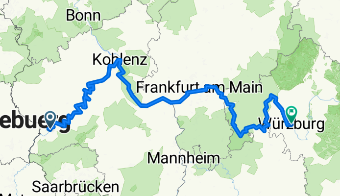
Mosel-Rhein-Main von Trier nach Würzburg
A cycling route starting in Trier, Rhineland-Palatinate, Germany.
Overview
About this route
Trier-Koblenz, entlang der Mosel: Radweg D5
Koblenz-Mainz, entlang dem Rhein:Radweg D8
Mainz-Würzburg, entlang dem Main: Radweg D5
- -:--
- Duration
- 616.5 km
- Distance
- 337 m
- Ascent
- 292 m
- Descent
- ---
- Avg. speed
- ---
- Max. altitude

Route quality
Waytypes & surfaces along the route
Waytypes
Path
215.7 km
(35 %)
Track
102.9 km
(17 %)
Surfaces
Paved
578.7 km
(94 %)
Unpaved
15.7 km
(3 %)
Asphalt
524.8 km
(85 %)
Paving stones
39.2 km
(6 %)
Continue with Bikemap
Use, edit, or download this cycling route
You would like to ride Mosel-Rhein-Main von Trier nach Würzburg or customize it for your own trip? Here is what you can do with this Bikemap route:
Free features
- Save this route as favorite or in collections
- Copy & plan your own version of this route
- Split it into stages to create a multi-day tour
- Sync your route with Garmin or Wahoo
Premium features
Free trial for 3 days, or one-time payment. More about Bikemap Premium.
- Navigate this route on iOS & Android
- Export a GPX / KML file of this route
- Create your custom printout (try it for free)
- Download this route for offline navigation
Discover more Premium features.
Get Bikemap PremiumFrom our community
Other popular routes starting in Trier
 Mosel-Radweg:
- Distance
- 193.9 km
- Ascent
- 393 m
- Descent
- 461 m
- Location
- Trier, Rhineland-Palatinate, Germany
 Trier-Koblenz
- Distance
- 229.2 km
- Ascent
- 330 m
- Descent
- 364 m
- Location
- Trier, Rhineland-Palatinate, Germany
 Tour der Leiden ;-)
- Distance
- 90.5 km
- Ascent
- 1,226 m
- Descent
- 1,037 m
- Location
- Trier, Rhineland-Palatinate, Germany
 Trier - Bernkastel
- Distance
- 66 km
- Ascent
- 182 m
- Descent
- 220 m
- Location
- Trier, Rhineland-Palatinate, Germany
 Gemütliche Route in Trier
- Distance
- 33.4 km
- Ascent
- 358 m
- Descent
- 360 m
- Location
- Trier, Rhineland-Palatinate, Germany
 Trier-Oberemmel-Biebelhausen-Saarburg-Mannebach-Onsdorf-Konz-Trier
- Distance
- 57.6 km
- Ascent
- 541 m
- Descent
- 544 m
- Location
- Trier, Rhineland-Palatinate, Germany
 Trier-Mariahof-Roscheid und zurück
- Distance
- 28.2 km
- Ascent
- 365 m
- Descent
- 297 m
- Location
- Trier, Rhineland-Palatinate, Germany
 Moselradweg
- Distance
- 150 km
- Ascent
- 792 m
- Descent
- 851 m
- Location
- Trier, Rhineland-Palatinate, Germany
Open it in the app