

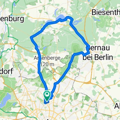
60km Liepnitzsee
A cycling route starting in Pankow, State of Berlin, Germany.
Overview
About this route
- -:--
- Duration
- 62.8 km
- Distance
- 172 m
- Ascent
- 166 m
- Descent
- ---
- Avg. speed
- 89 m
- Max. altitude

Route quality
Waytypes & surfaces along the route
Waytypes
Busy road
22.3 km
(36 %)
Pedestrian area
10.9 km
(17 %)
Surfaces
Paved
51.4 km
(82 %)
Unpaved
6.7 km
(11 %)
Asphalt
47 km
(75 %)
Ground
4.4 km
(7 %)
Continue with Bikemap
Use, edit, or download this cycling route
You would like to ride 60km Liepnitzsee or customize it for your own trip? Here is what you can do with this Bikemap route:
Free features
- Save this route as favorite or in collections
- Copy & plan your own version of this route
- Sync your route with Garmin or Wahoo
Premium features
Free trial for 3 days, or one-time payment. More about Bikemap Premium.
- Navigate this route on iOS & Android
- Export a GPX / KML file of this route
- Create your custom printout (try it for free)
- Download this route for offline navigation
Discover more Premium features.
Get Bikemap PremiumFrom our community
Other popular routes starting in Pankow
 Bernau Trainingsrunde
- Distance
- 47.9 km
- Ascent
- 60 m
- Descent
- 55 m
- Location
- Pankow, State of Berlin, Germany
 60km Liepnitzsee
- Distance
- 62.8 km
- Ascent
- 172 m
- Descent
- 166 m
- Location
- Pankow, State of Berlin, Germany
 50er Lehnitz
- Distance
- 50.6 km
- Ascent
- 116 m
- Descent
- 113 m
- Location
- Pankow, State of Berlin, Germany
 100 km Runde
- Distance
- 101.6 km
- Ascent
- 258 m
- Descent
- 244 m
- Location
- Pankow, State of Berlin, Germany
 Oderbruch-Tour in der Hügel-Variante
- Distance
- 149.6 km
- Ascent
- 336 m
- Descent
- 339 m
- Location
- Pankow, State of Berlin, Germany
 Wochendtrainingsrunde - Rennrad geeignet
- Distance
- 113.1 km
- Ascent
- 167 m
- Descent
- 167 m
- Location
- Pankow, State of Berlin, Germany
 Berlin-Pankow Ruhlsdorf-Berlin
- Distance
- 82.1 km
- Ascent
- 153 m
- Descent
- 154 m
- Location
- Pankow, State of Berlin, Germany
 Stadtführung Berlin, Radtour durch die östlichen Randgebiete von www.stadtspiele-verlag.de
- Distance
- 48.5 km
- Ascent
- 57 m
- Descent
- 65 m
- Location
- Pankow, State of Berlin, Germany
Open it in the app