

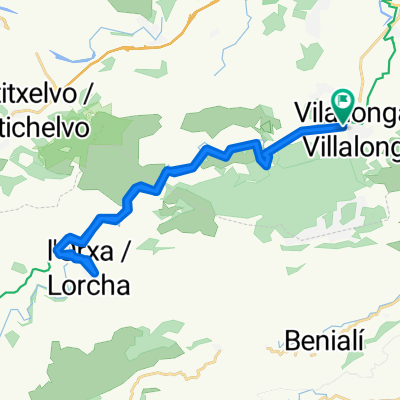
València/Alacant: Villalonga-L'Orxa-Villalonga
A cycling route starting in Villalonga, Valencia, Spain.
Overview
About this route
A walk through the most spectacular section of the Via Verda del Serpis: the Racó del Duc or Barranc de l'Infern. Crossing 5 tunnels and passing old electricity factories, weirs, abandoned stations, and other disused railway infrastructure. With the waters of the Serpis always alongside. Fantastic.
- -:--
- Duration
- 28 km
- Distance
- 585 m
- Ascent
- 582 m
- Descent
- ---
- Avg. speed
- ---
- Max. altitude
Route quality
Waytypes & surfaces along the route
Waytypes
Track
19.6 km
(70 %)
Quiet road
7 km
(25 %)
Access road
1.4 km
(5 %)
Surfaces
Paved
1.4 km
(5 %)
Unpaved
18.7 km
(67 %)
Gravel
18.7 km
(67 %)
Paved (undefined)
0.8 km
(3 %)
Route highlights
Points of interest along the route

Photo after 1.8 km

Photo after 6.5 km

Photo after 7.7 km

Photo after 8.8 km

Photo after 8.8 km

Photo after 8.8 km

Photo after 10.1 km

Photo after 11.1 km

Photo after 13.8 km

Photo after 14 km

Photo after 14 km

Photo after 14.2 km

Photo after 15.1 km

Photo after 15.3 km

Photo after 16 km

Photo after 16.6 km

Photo after 18.3 km

Photo after 19.2 km

Photo after 21.7 km

Photo after 22.4 km
Continue with Bikemap
Use, edit, or download this cycling route
You would like to ride València/Alacant: Villalonga-L'Orxa-Villalonga or customize it for your own trip? Here is what you can do with this Bikemap route:
Free features
- Save this route as favorite or in collections
- Copy & plan your own version of this route
- Sync your route with Garmin or Wahoo
Premium features
Free trial for 3 days, or one-time payment. More about Bikemap Premium.
- Navigate this route on iOS & Android
- Export a GPX / KML file of this route
- Create your custom printout (try it for free)
- Download this route for offline navigation
Discover more Premium features.
Get Bikemap PremiumFrom our community
Other popular routes starting in Villalonga
 Villalonga-Alfafara
- Distance
- 43.7 km
- Ascent
- 801 m
- Descent
- 222 m
- Location
- Villalonga, Valencia, Spain
 Verbindings route ALC - SAC
- Distance
- 48.7 km
- Ascent
- 68 m
- Descent
- 150 m
- Location
- Villalonga, Valencia, Spain
 Via verda del riu Serpis. Tramo 1: Villalonga - L'Orxa
- Distance
- 32.3 km
- Ascent
- 441 m
- Descent
- 441 m
- Location
- Villalonga, Valencia, Spain
 SAC Vuelta Via Verde Villalonga - Denia
- Distance
- 56.5 km
- Ascent
- 236 m
- Descent
- 726 m
- Location
- Villalonga, Valencia, Spain
 VI MARXA BTT EL LLOP 2014 (OFICIAL)
- Distance
- 30.9 km
- Ascent
- 586 m
- Descent
- 587 m
- Location
- Villalonga, Valencia, Spain
 de la 3ª Marcha BTT El llop - Villalonga
- Distance
- 38.1 km
- Ascent
- 967 m
- Descent
- 972 m
- Location
- Villalonga, Valencia, Spain
 Villalonga-Gandia
- Distance
- 11.5 km
- Ascent
- 0 m
- Descent
- 0 m
- Location
- Villalonga, Valencia, Spain
 Villalonga - Lorxa
- Distance
- 14.2 km
- Ascent
- 662 m
- Descent
- 482 m
- Location
- Villalonga, Valencia, Spain
Open it in the app