

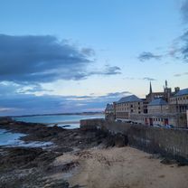
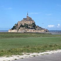
F: Day 6 Alternative Mont St Michel / Beauvoir to Ger
A cycling route starting in Pontorson, Normandy, France.
Overview
About this route
Getting hillier towards the end 77 km, Gradual then steeper at 60 km climb 530m total
- -:--
- Duration
- 77 km
- Distance
- 449 m
- Ascent
- 175 m
- Descent
- ---
- Avg. speed
- ---
- Max. altitude

Route quality
Waytypes & surfaces along the route
Waytypes
Path
31.6 km
(41 %)
Road
22.3 km
(29 %)
Surfaces
Paved
13.1 km
(17 %)
Unpaved
28.5 km
(37 %)
Gravel
28.5 km
(37 %)
Asphalt
13.1 km
(17 %)
Undefined
35.4 km
(46 %)
Continue with Bikemap
Use, edit, or download this cycling route
You would like to ride F: Day 6 Alternative Mont St Michel / Beauvoir to Ger or customize it for your own trip? Here is what you can do with this Bikemap route:
Free features
- Save this route as favorite or in collections
- Copy & plan your own version of this route
- Sync your route with Garmin or Wahoo
Premium features
Free trial for 3 days, or one-time payment. More about Bikemap Premium.
- Navigate this route on iOS & Android
- Export a GPX / KML file of this route
- Create your custom printout (try it for free)
- Download this route for offline navigation
Discover more Premium features.
Get Bikemap PremiumFrom our community
Other popular routes starting in Pontorson
 De 16bis La Caserne, Beauvoir à 11–17 Rue de la Grève, Pontaubault
- Distance
- 15.1 km
- Ascent
- 0 m
- Descent
- 11 m
- Location
- Pontorson, Normandy, France
 Belvoir bis Staint-Malo
- Distance
- 62.3 km
- Ascent
- 159 m
- Descent
- 203 m
- Location
- Pontorson, Normandy, France
 trans mt st nichel
- Distance
- 35.1 km
- Ascent
- 499 m
- Descent
- 468 m
- Location
- Pontorson, Normandy, France
 F: Day 6 Alternative Mont St Michel / Beauvoir to Ger
- Distance
- 77 km
- Ascent
- 449 m
- Descent
- 175 m
- Location
- Pontorson, Normandy, France
 vacances Bretagne Mont Saint-Michel - Nantes
- Distance
- 712.2 km
- Ascent
- 4,189 m
- Descent
- 4,171 m
- Location
- Pontorson, Normandy, France
 3 Place de la Gare, Pontorson to 37 Rue du Port, Cancale
- Distance
- 53.5 km
- Ascent
- 106 m
- Descent
- 82 m
- Location
- Pontorson, Normandy, France
 Stage 2 Pontorson to Fougeres
- Distance
- 38.3 km
- Ascent
- 396 m
- Descent
- 301 m
- Location
- Pontorson, Normandy, France
 Pontorson - Ducey-Les Chéris
- Distance
- 29.4 km
- Ascent
- 56 m
- Descent
- 61 m
- Location
- Pontorson, Normandy, France
Open it in the app